Tuesday, 27 March 2012

Shepley to Stocksmoor – Yorkshire – 21/03/12 – 10 Miles – R’mblers


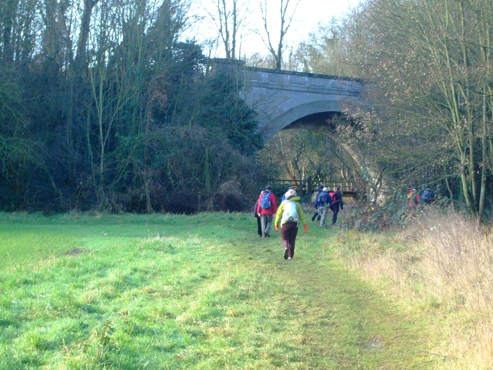
My second outing with Ramblers in 4 days and I was very surprised to see the numbers for a midweek outing, exceeding those on a Sunday, with the total somewhere around the 25 mark. The weather had cooled slightly but it was still a more than acceptable Spring day.

Anyway to quickly run through this one we started at Shepley, and continued en route through: Upper Cumberworth, High Flatts, Cheese Gate Nab, Hole Bottom, Stone Wood Dike, before finishing at Stocksmoor.

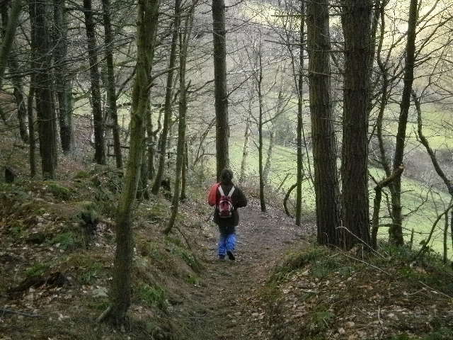
This was one of those walks where I did more chin wagging than looking around. However what I did notice were: the fine views from the high vantage points, a series of wind turbines that didn’t seem to be turning, and at the end a turkey that was already carrying his full Christmas weight.

Still chatting about football as we neared Stocksmoor station the leader had to remind us to get a move on, as the hourly train went at 1629 back to Sheffield, and it was already 1621. Once on the train though I was a bit concerned that I should have bought a one stop extension back to Shepley. However the cute train guard seemed keen to check everyone elses tickets whilst giving all of us ramblers a wide berth.

Walks since last blog entry:
Somersall (circular) – 3.5 miles – Helen (Molly)

Monday, 26 March 2012

Bakewell to Rowsley – (Peak District) – Derbyshire – 18/03/12 – 12 Miles – R’mblers


My first outing with Ramblers nearly didn’t take place given how hard it was raining at seven in the morning. However after some reassurance from Sky News I decided to give it a go anyway, which was just as well as it turned out to be a really pleasant Spring day. Yet having arrived on my own in Bakewell I nearly missed out a second time, as I waited on one side of the road for the main group’s bus to arrive, whilst they were quietly getting off a little further down on the other side.

That resolved a group of about 19 of us set off, initially through the back streets of Bakewell, but soon were passing through Over Haddon, and then onto Youlgreave, where we stopped in due course for some elevenses.

Continuing on along the Limestone Way, we passed a sign post for Lathkill Dale, but instead of going along that we made our way up some steep rock face. This ascent being the second point on the walk where I managed to make myself look a pratt by slipping over. However by the time the group decided to stop for lunch I assumed I had put all that behind me. So having found a nice little rock inside a small cove to sit on, I was surprised to hear the ‘ready in one minute’ call a mere 20 minutes in (I was still on my mini-cheddars). So leaping up to attention I managed to bang my head on the rocky stone above me (ho hum).

We then began a very steep ascent on some very slippery mud/grass (still sopping from the mornings rain) where to my surprise I managed to stay on my feet. At this point however a few of the stragglers obviously became disorientated and took a wrong turn, leaving the rest of the group waiting for them at the bottom by a small bridge over a stream (still on the Limestone Way). There then followed a lively debate over whether we were going to make the 1656 hourly bus at Rowsley or not, if people didn’t get a move on.

We continued on what I assume was the second of the advertised Dales on this walk, where we began to warm nicely in the afternoon sunshine. As we passed Robin Hoods Stride on our right we passed a large group of red helmeted school children, preparing to make their way up it.

As the walk neared its conclusion we made our way through Stanton Moor, passing nine ladies, before eventually beginning a long descent down towards Rowsley, in the course of which there was more debate over whether we had misplaced someone. However with them located some way ahead of us, we touched down in Rowsley where it turned out there was sufficient time after all for some of the group to get a drink, and others to look into a garden centre.

Having been with IVC so long there are a few differences I will have to get used to, but it was a good day and a nice first outing with the group.

Chatsworth Circular - 16/03/12 - Helen (Molly) - 3.92 miles


A short few notes for a short walk. That said this was an attractive little ramble initially along the high ground overlooking the Chatsworth estate, before finishing along the river on the far banks of it. In the course of our wanderings we stodged up on the hardest of baguette's, and came across a wedding party in the estate church, with bell ringing accompanyment.

Thursday, 1 March 2012

Monsal Head (circular) – (Peak District) – Derbyshire – 26/02/12 – 5.25 Miles – Helen, Ally, Grant (Molly)

Our now regular trio of myself, Helen, and Molly, were joined for this trek by youngsters Grant and Ally. One of whom wants to get into walking more, and the other one whom Helen wants to remind of the benefits. So both Helen and myself agreed that this particular route which we last did in May was an ideal short and scenic Peak District promo. For my part I was firing on a lot more cylinders than the previous week, although as usual never quite the full quota.

So after completing the tourist shots overlooking Monsal viaduct, we descended down some steps, over the river, and climbed up this time to join the Monsal trail. As is now usual there was a fair quotient of cyclists about, requiring Molly staying on her lead, however by the time we reached Cressbrook Mill, and come off the trail, we were able to let her run free again.


Descending down to Water cum Jolly, we were able to reminise about the time Molly nearly decided to run with the rapids on the weir there, as well as point out the place where Luther made an unscheduled swim. The first time I ever did this walk with Helen (not last May) there was too much water about to walk along the limestone walls. Not this time however, and we were all able to enjoy the tranquillity of the surroundings, as we were passed by other walkers with the occasional dog. As time was moving on two of our party (myself being one of them) were whinging for lunch, so eventually we had it there alongside the water.

After briefly crossing over the Monsal trail again, we began the day’s steep climb. Myself and Grant pushed each other on in the usual macho male way, whilst the three ladies took a more leisurely approach. One thing I find with walks is that the best views are often behind you, however on this occasion we all took our fill of Millers Dale, whilst taking assorted snaps for posteriety. I then tried to lead us astray whilst following a couple of walkers ahead of us, until the GPS in the grey fleece, put me back on track again.

Further along I looked once more to add some element of tension and uncertainty to proceedings, as I then wondered aloud whether we were still on the correct path with no promised farmyard in sight. However the newer member of our party then produced an app on her mobile, which was able to give us a satellite aerial shot of where we were and where we were heading (which is alright if you like that sort of thing I suppose).

Some of the best views on this walk are when you make the stony descent on the approach to Monsal Head, before eventually crossing over the viaduct. Following which we finished with a steep climb up the steps, where a little girl asked me if I was alright after I stumbled. At the top one is greeted with a choice of ice cream van, pub and tea shop. We chose the latter, having our cake and coffee outside, whilst watching the assorted walkers, cyclists, dog walkers, motorbikers, and hot hatchbacks, that seem to hang around there.

Monday, 20 February 2012

Black Rock (circular) – (Peak District) – Derbyshire – 18/02/12 – 6.64 Miles – Helen (Molly)


The first thing that hit us when we got out of the car park, overlooked by Black Rock, was that it was bloody cold in the breeze (never mind that deceptive winter sunshine). So given that I hadn’t been firing on all cylinders throughout the week, by the end of the walk the cold did eventually take its toll on me.

Still forgetting about me being the ‘old soldier’ for now, the walk began on what is the High Peak trail, which seemed to interlink for some way with the Tissington Trail. As we looked over and below to our left we could see Matlock Bath, the ruins of Riber Castle, and a moonscape of a quarry. Both of us were a little bothered by the cold, in a find an ‘out of sight place’ sort of way. But with that taken care of, we were amazed to see a run off point for engine wagons (called a catch) on the downwards trail, created for its previous incarnation as a railway line. We were then even more amazed to see it is still filled with overturned.

However having then passed some better preserved wagons (in a visitor centre sort of way) we arrived at High Peak junction, where we had lunch on one of the available benches. There we were joined on the table by a small doggie (Helen thinks terrier, I think Scottie) who was either very interested in what we were eating (Salmon roll) or Helen herself (they know a doggie person when they see one). Strangely enough Molly didn’t seem to pay this little scamp any notice at all. However with a group of ramblers having turned up on the other benches, our new doggie friend decided to head in their direction, before the ducks cornered all of their lunch box action.

We continued along the Cromford canal towpath, where it passes over the River Derwent, passing in the process Lea Wood Pump-house (open certain days at the year where you can witness canal and river exchanging fluids). Molly was then spooked by a train running underneath the canal, where it passes over the railway.

Our journey back to the start point was via Cromford Moor with Crich tower constantly in the distance as we made our way through various wooded and open areas. It did briefly rain on us (sleety) but fortunately I had a brolly, which I was prepared to let Helen hold for me. By this time I was seriously flagging (man-flu) and unusually was happy for Helen to be the one in front on the very steep climb towards the end of the walk that overlooked Wirksworth. Having reached (eventually) some of telecomm mast or other, we then began the descent back to the car, whilst having a few snaps of Black Rock. Speaking of which, apologies if the pix are a little grainier than normal, but I forgot my camera and had to use Helen’s.


Walks since last blog entry:
Monsal (circular) – 3 miles

Monday, 16 January 2012

Tideswell (circular) – (Peak District) – (Derbyshire) – 14/01/12 – 8.75 Miles – Helen (Molly)


On the coldest of days we began our winter wonderland trek at the disused station at Millers Dale. Thus the amazing visual thing about this walk was the contrast between bright winter sunshine, and the carpet of white frost in the shaded areas (a contrast that was to last for the whole duration). Anyway this particular point on the Monsal Trail appears to be a very popular start point for both walkers and the cycling fraternity, no doubt in part because the station facilities are still in use. So once two out of the three of us, had made use of available facilities, we were on our way.


Basically we didn’t stay on the trail long enough to be bothered by the cyclists (which seems to be a bit of a problem in walking circles at the moment). Thus once we had passed the lime kilns, we headed off up towards Wormhill. As responsible dog owners/walkers (well most of the time) we followed instructions and kept Molly on her lead. This being just as well as we soon encountered a local farmer (+ working dog) rounding up his flock of sheep. Unsure of what to do, we basically watched proceedings until he said we could move on, whilst he bemoaned that he was one sheep missing. So in our quest to continue to do the right thing, I decided to shut the next open gate we came to, only for a loud voice to bellow “leave it open”. Thus we hurried on, eager not to be trampled by the flock, once the numbers were complete.

Lunch wasn’t too long after, but given the cold one didn’t want to sit still for too long. However Helen (who periodically enjoys making me retrace my steps uphill) tried to pull a ‘lost her glasses gag’ which I refused to fall for (they were of course in her rucksack). So presently we passed through the village of Tunstead, which seemed to consist of two semi-derelict houses and a red phone box with no door. We then had trouble negotiating some fields where the OS trail seemed to be deliberately run down, as if to discourage pesky walker types. Latterly some farm dogs didn’t make us feel all that welcome either, when we passed them by on our way to Dale Head (Molly however maintained an air of nonchalance).

At Dale Head we joined the Limestone Way, passing though Peter Dale, which was waterlogged but frozen (and spectacularly beautiful). However when we came out of that and attempted to continue through Monks Dale, it became too much water and too little ice. Thus we made a strategic withdrawal, and instead headed on up the road to pick up the Limestone Way again.

However after a bit of zigzagging along some dry stone walled fields, the woman in the black woolly hat, misplaced the Limestone Way somewhere (I take no responsibility as I was playing follow the leader). Anyway a check between the GPS and the OS map, confirmed we were a little further over than thought, at a fork called Meadow Lane. So although it was getting late in the afternoon, with the sun setting on our right, it didn’t present a real problem, as following the road took us all the way down (and eventually up some steps) to where the car was parked at Millers Dale. As we reached the car we saw the last of the day’s other walkers packing up to head home, no doubt like us doing a quick mental double check that they had taken all their litter etc’, home with them.

Anyway this was a really good walk (which I think even began to wear the energetic Molly out), so much appreciation to the woman in the brown coat who thought of it. However her suggestion that we then head off dancing before we went home, was appreciated as much as the smell of silage on my boots and gators.

Monday, 2 January 2012

Farningham Road to Otford – (Kent) – 02/01/12 – 9 Miles – IVC

There was a double figure turn out for this bank holiday walk to see in the new year. Thus whilst there was a slight chill in the air, there was no wind to exacerbate it, and it was a very bright day. That said I can’t ever recall doing a walk before, where the Sun was so irritatingly low and in your eyes, the entire day.

Anyway the first half found us walking along the Darent valley path, in the process of which we crossed a set of footbridges over the River Darent, confirming to me that I had done this walk with IVC before. As we headed off towards Eynsford we spotted Eynsford castle (pictured) to our left, which apparently dates back to 1088 (them Normans built things to last).


After crossing the Ford going into Eynsford we stopped for a pub lunch. I had the malt burger (local delicacy) and chips, which seemed a tad underdone, as well as a pint of local cider.


The second half found us following the crowded path beside the River Darent. Before long Lullingstone Roman Villa (which apparently is all enclosed within the visitor centre), but which was shut for the Bank Holiday. A little further on and we came across Lullingstone Castle and its restored 16th century gatehouse. From there on it was a case of glooping along in the mud (with the crowds having thinned out) alongside the river. A couple of the group dropped out at Shoreham, but the rest of us continued on to Otford. There we saw the local church covered in various types of cladding. However in a sign of the times a notice read: ‘if you see workman on our roof between 6pm and 8am, phone the police as they are probably stealing it’.


So overall a good walk, save for the Sun constantly in ones eyes, given that we always heading South. I can’t tell you the exact distance as the pound shop batteries in the GPS, gave up in the pub but our leader assured us it was around nine miles.