Monday, 7 November 2011

Oxted (Loop) – (Surrey/Kent) – 06/11/11 – 10 Miles – IVC


Given how late I was finishing work on Saturday, the fact that my two connecting hourly SWT trains would miss each other by two minutes on my way home, and it was down to a replacement bus service on the Piccadilly line, I decided that this walk was going to be a non-starter. Yet human nature being what it is, come Sunday morning I decided I was raring to go anyway, and did. The other thing pushing me on (as mentioned last week), was the fact that this could be one of my last opportunities to go walking with IVC. So whilst contemplating all this at Clapham Junction for the train to Oxted, I treated myself at Costa’s to a cream topped hot chocolate in an impressively tall glass (I thought primo meant small).

The majority of this walk involved following the Greensand Way (which has featured on other IVC walks before, including one I led) heading East towards Crockham Hill, whilst returning back to Oxted via a different route. Like last week, I was doing so much chinwagging for the first half at least, that I wasn’t paying too much attention to where we were going. That said when I did look up, one noticed that at lot of the first half was actually going through villages, as much as open country.

A relatively early lunch stop found us at the only pub in Limpsfield Chart which is called The Carpenters Arms. They seemed both walker and dog friendly (not ours), and didn’t seem too phased by our numbers. I had a pint of cider as well as ham, eggs, and chips. This was all very acceptable except the amount of chips was a little on the low side.


The second half of the walk was a lot less village and a lot more country (good), and eventually found us crossing into Kent. There we passed Churchill’s house Chartwell. Well I say passed, in fact two of us with cameras made a small detour so we could get a picture of it. Further along we also passed a large number of Canadian Geese having a meeting in the middle of a field.


It was certainly not what you would call a bright winter’s day. Thus given the fact that the clocks have gone back, and this group seems to have an average pace (given all the stops and catching up) of two miles an hour, things were getting seriously gloomy near the end of this walk (Considerably so whenever we crossing through a wooded area). Thus by the time we made it back into Oxted, the street lighting was something of a relief. As we had three quarters of an hour to kill before the 1728 back to Victoria, we all piled into the next door (to the station) Wetherspoon’s for coffee and biscuits.

Sunday, 30 October 2011

Hildenborough to Tonbridge – (Kent) – 30/10/11 – 6.75 Miles – IVC


One of the great things about a walking group like IVC, is that you can be absent for well over four months, and then slot straight back in again, as if you have never been away. Anyway with an extra hour in bed due to the clocks going back, there was no excuse for not getting up for this one.

This was basically a short walk, down the Medway Valley, admiring the autumnal colours as one strolled along. Although given my long absence, I tended to do more chinwagging about what I have been up to, then I did admiring the scenery. Thus some three and a bit miles in we had arrived in Leigh for lunch.

Lunch was at the Fleur De Lis pub, who promptly explained that all the tables were booked inside, and even with us sitting outside, we could forget about ordering any roast dinners. Thus we made the best of it, by ordering a variety of baquetee’s, which were served promptly enough. They then seemed a bit undecided about whether we could order pudding, but eventually our pleading hungry faces won through, and for my part I had a sticky toffee one with ice cream.

The second half of the walk continued on much the same undemanding territory as the first. Now as you will notice there is only the one photograph on this occasion. Now there are two explanations for this, so choose whichever you prefer.

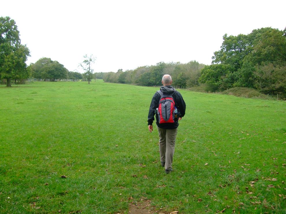
One – People pulling cameras out are not always welcomed on group walks, especially when you try and surrepticiously include other walkers in said pictures for effect. It’s also quite difficult to take pictures when you are constantly having conversations with people. So what I often do is hang back from the rest of the group, on the pretext (true or not) of having a call of nature, and thus get a group shot that way. On this occasion however whilst I was taking my picture, one group member in front of me and to my left, actually was having a call of nature. Thus he was somewhat panicked by my flash going off, as was I by his startled shout (see picture for proof of me being startled, which he is not in by the way). Anyway despite my embarrassed explanations he no doubt has me down now as some weird pervert. Trying to explain that I wanted the picture for my website (this blog actually) would no doubt have made matters worse, so I left bad enough alone.

Or

Two – When I saw how much my photograph resembled one of the great ‘impressionist masters’ I decided I couldn’t possibly top that, and decided that was all I needed to take for the day.

Anyway we ended up in Tonbridge for our much vaunted afternoon tea stop, in some grimy local café. The menu was pretty ropey, but for my part I had a hot chocolate that tasted like slime and a toasted tea cake. One elderly drunk who had been having his lunch tried to claim, some twenty minutes after we came in, that someone in our party had brushed past him, ruining both his dinner and his life. There are some people in this world who are worth apologising too, and some who just need to be told to fuck off. He was in the latter category, but because the people in this group are of the civilised variety they wrongly tried to take the former approach. Anyway this was all going off at the far end of the table from me, but when I managed to get his attention, and asked him, why didn’t he say this at the time and not twenty minutes later, he stormed out of the café ranting away still.

Still nice to be back walking with IVC again. I wasn’t sure back in June whether that would be the last time, I would be out with them, and for that matter the same applies to today. So watch this space.

Walks since last blog entry:

1 x 7 miles – Osterley Park/Grand Union
1 x 7 miles – Grand Union/Osterley Park
1 x 2.5 miles – Lineacre Reservoir
1 x 6.5 miles – Putney to Kew Bridge

Wednesday, 12 October 2011

Bath Skyline (Circular) – (Somerset) – 09/10/11 – 8.5 Miles – Helen

So yes things have been a little quiet on the blogging front as of late, especially given the walks that I have been doing (see list at bottom), are ones that have been covered many times before. So I decided what was required to invigorate the blog was somewhere untrodden, and looking at October’s Country Walking magazine I opted to do the Bath Skyline one (as featured on pages 44-48, and as cut out route (2)). Well alright I just happened to be in Bath this particular weekend for a long planned trip anyway, but hey why not run with it.

So if you are groping for the magazine even as you are reading this, the first thing to note is that we started/finished at point 3 on Bathwick Hill, as per route cut out. However to get to that point we actually started the walk at the bus station, which in itself required a mile each way to the official start (hence 8 miles, and add another half again allowing for us getting lost).

So as such our start point as per the cut out, was the one that really affords the classic view of Bath’s skyline. However as you have probably noticed already, the picture of me here isn’t as good as the one on pages 44-45 of Country Walking magazine. However I can come up with three reasons for this: (1) – Helen wasn’t standing on a ladder to take the picture, (2) – It was a bit dull and grey for our walk, and (3) – unlike CW magazine, I don’t have the facility to airbrush out the gasworks. Oh yes and if you are wondering why I am looking like the ‘elephant man’ it was because my cheeks were full of Galaxy Minstrels.

Now I accept that not all cut out walks in CW magazine are of uniform standard, however we found the instructions early on to be particularly ropey, getting lost immediately past Richens Orchard. However by a process of elimination we finally decided that when presented with three options ‘bear diagonally L uphill’ really means ‘bear diagonally R uphill’. Anyway given that this is a standard signed walk (as featured at the tourist information centre) the best option in fact was to follow the circular post markers.

There was a fair bit of climbing involved early on, which led to us briefly taking our jackets off. In fact we made such an attractive couple at this point, that we were stopped by a National Trust warden who asked permission to take our picture (God knows what for). However he went down in my estimation when he showed no interest in looking at the pictures on my camera screen. However he did say we had done the worst of the climbing at this point.

The wind was blowing up a bit and with one o clock fast approaching, there didn’t seem anywhere particularly suitable to have our sandwiches (save for a bench inbetween a load of American Footballers). Eventually however we settled on a wall in earshot of Bath Cats and Dogs home (guess which species made its presence most felt there).

As we made our way onwards towards Bathampton Woods, we came across a number of cavaliers, roundheads and student types, who eventually overtook us, before we in turn overtook them. By this time the mizzly nature of the day was making itself felt as we passed the TV mast. Thus when we reached the bench for the ‘great viewpoint’, both the weather and the canopy was giving us anything but. Helen decided she could live without the diversion off to Sham Castle (no doubt fearing being financially mugged at yet another visitor centre), and thus we headed back down towards our start point at the junction of Cleveland Walk/Bathwick Hill. The instructions surpassed themselves yet again at this point however, as we ended up somewhere else entirely. Following which the walk came to something of an indeterminate end as we wound our way through the centre of Bath looking at greeting card and coffee shops.


Walks since last blog entry:

2 x 7 miles – Osterley Park/Grand Union
1 x 9.25 miles – Putney to Osterley
1 x 4.5 miles – Osterley Park (inner/outer loops)
1 x 9.44 miles – Richmond Park (outer loop + rtn. Richmond stn.) – Helen
1 x 7 miles – Hellbank/Chatsworth (circular) – Helen (Molly)

Tuesday, 23 August 2011

Win Hill (circular) – (Dark Peak District) - (Derbyshire) – 20/08/11 – 8 Miles – Helen (Molly


After some effort to find a place to park we eventually located a tailor made effort alongside the Thornhill Trail. We weren't sure however was the woman in the marquee collecting parking tariffs or not, but a check from Helen revealed she was just doing a survey.

So after picking up said trail we weren't on it for long, before a sharp right took us up the stone staircase to Win Hill. This required some effort on our part, especially as everyone else seemed to be taking the easy way downwards. Well that is except for two lads who seemed to have taken a wrong turn with their mountain bikes, carrying them up ahead of us; and of course Molly who was going both upwards and downwards..

Around half way to the top we found a pile of stones to have lunch on, while Molly looked on wondering what had happened to her Bonio (an apple core having to substitute). Following which she decided to act somewhat retarded when it came to drinking out of the blue plastic thing Helen had brought along for her (probably still waiting for that Bonio).


So picking up the trail again (past some young energetic types, who had been running downhill), we constantly turned around to gawp in admiration at both the view and the carpet of purple heather. Thus in just a few short strides (or not) we found ourselves at the top of Win Hill, save for three lads taking pictures, and about 10 million enormous great flies. However such was the stunning views of green and purple around us, for brief moments one could pretend the flies weren't there. When I say view that of course excludes the one of the cement works, which Helen tried to talk up by calling it something like Hope Castle.


There were more stunning and greener views on the way down with Helen pointing out the likes of Mam Tor, Lose Hill, and Kinder on the horizon, meanwhile some guy appeared out of nowhere on his bike, looking for all the world like he was in the middle of delivering the local papers. So after negotiating a pine wood + christmas tree plantation, we found ourselves walking along Ladybower reservoir. In this instance the scenery wasn't great (not helped by the road opposite). However Molly had a brief dip in the water, the levels of which seem worryingly low.

After a brief break at the Dam crossing, Helen's map reading skills went on a bit of a walkabout at this point, insisting we must climb upwards, when the Thornhill trail sign said straight ahead. Something about avoiding a road somewhere ! Anyway we eventually found ourselves on the stone staircase again, only this time coming down back onto the path we had just left. Fortunately I only fell the once, and managed to break my fall and not my arm (not so good with descents you see).

Back at the car the GPS proved it could stay switched on for the duration of a walk, with real batteries rather than rechargeable ones. However it was having a bit of trouble with distances (probably getting its confidence back up), so instead we ignored its guesstimate and came up with one of our own (8 miles).


Walks since last blog entry:

1 x 7 mile – Osterley Park/Grand Union
1 x 15.5 mile – Richmon Stn/Park (outer/inner loops) and back
1 x 2.5 mile – Ashover (circular) – Helen (Molly)

Wednesday, 27 July 2011

Curbar Edge (circular) – (Peak District) - (Derbyshire) – 23/07/11 – 9 Miles – Helen (Molly)


You know it must be July, when it’s time to put the fleece’s and waterproof’s back on. So having parked at Curbar Gap, there was nothing about the weather that suggested we would be taking them off any time soon. Well okay it wasn’t raining exactly, but then it wasn’t exactly the height of April either (please read previous blog entries to understand that). Anyway what we did have was a very clear day, so as we made our way along Curbar Edge we could see for miles around. Not that this was of particular interest to Lab dog Molly, who had umpteen trails to follow (but sadly without Luther, as such outings are getting a bit too much for him these days).

Thus for a late Saturday morning, this neck of the woods (or Peak) was proving a popular spot with other people as well, but once we made a hard right and headed off towards White Edge we managed to shake off the masses. Not only that but the effort to climb up to the edge, had me taking my waterproof off a little too hastily, as once exposed to the biting wind it soon found its way back on again. It turned out we hadn’t shaken off humanity either as we met a group of ramblers heading towards us. One of whom had an identical black Labrador and informed us that he kept his on a lead to protect it from ticks (we however assumed our dog would be able to stand up to a tick if it happened to meet one).

Following a quick lunch stop on a stone ledge where we had frozen sandwiches and crisps, washed down with that biting wind, we then headed down towards the Grouse pub. There we had a quick mug of coffee outside, whilst Molly barked at and attempted to verbally bully a small dog that was entering with its owners (all the while keeping her back to the window where a Staffy/Rottweiller cross was looking out, who was no doubt hoping for the opportunity to bully her).

Once on the move again, the weather had warmed up, and the top layers were coming off. Thus we passed around the outskirts of Longshaw estate, as we made our way towards Froggat edge. We were somewhat surprised when two guys passing us, suddenly shouted “Helen” on the top of their voices. When a young woman passed us by a few moments later we realised both that: there is more than one of them who lives in Derbyshire, and that this one was probably rushing to thank her mates for (not) holding up the traffic whilst she was (assume) answering a call of nature.

After being shown a stone circle by the first Helen mentioned in this blog, we then speculated (me and Molly that is) as we stared over Froggat edge, whether we were looking at my old stomping ground of Grindleford. With no real definitive answer to that one forthcoming, we instead went through something of a photography moment around all the jagged stones and rocks.


Presently we made our way back to the Curbar Gap car park where we came across a wedding party having their photos taken. In fact they came into view at just the right moment as we would otherwise have had to come to blows over whether a Tomato is a fruit or a vegetable. Anyway having found some common ground on the distance being something around the 7 mile mark (no thanks to my malfunctioning GPS), we were then able to drive home happily listening to Status Quo’s ‘Leader of Sound’.


Walks since last blog entry:

2 x 7 miles – Osterley Park/Grand Union
1 x 2 miles – Lineacre Reservoir (circular) – Helen
1 x 2 miles – Hellbank (circular) – Helen

Sunday, 26 June 2011

Chequers/Coombe Hill (figure of 8) – (Buckinghamshire) – 24/06/11 – 9 Miles – Helen


So if you’re sensing a tad of deja-vu here, you’re correct this is the same walk I did last time out on this blog as well. The reason for the hasty repeat, is that Helen wanted to try the full circuit (as well as IVC) after we had got ourselves lost the first time out we tried it.

So rather than retread old ground describing too much of the walk again, let me bang on about the journey instead. Thus on my previous three outings here, I had taken the underground from Osterley to Marylebone, and then Chiltern railways to Wendover. However Helen didn’t fancy the long traipse into London only to in effect, come all the way back out to Wendover. I on the other hand didn’t fancy driving all the way to Wendover and back on a rush hour Friday. However thanks to the tube dot com, we were able to follow an alternative travel plan. So here it is.

Take a 12 minute walk from home to Osterley station. Then travel from Osterley to Acton Town, cross over the platform. Then travel Acton Town to Rayners Lane, cross over the platform. Then travel Rayners Lane to Harrow on the Hill, cross over the platform. Hang around there some 30 minutes for an Amersham train, then hastily cross over the platform again when it turns up on a different platform than it is supposed to. Eventually arrive at Amersham, and cross over the platform to buy a ticket for Chiltern Railways, then cross back over the platform again to get the train to Wendover, only to find you have just missed it and will have to wait half an hour for the next one. Arrive at Wendover the best part of three hours later, having lost all idea of why you had actually travelled there in the first place.

Anyway suffice to say we didn’t fancy that route back home again. Thus we took the Chiltern Railways train back to Harrow on the Hill, and then picked up on the previous journey only in reverse order. Although this enabled us to take about an hour off the journey it was something of a pyrric travelling victory.

However returning to our eventual arrival at Wendover, we decided we didn’t want to begin the walk until we had our lunch. To this end we were excellently served by the Shoulder of Mutton pub just outside the station (where I had afternoon tea the other week with IVC). We both had the fish and chips and mushy peas, which were of a much higher standard than what most pubs throw up, and to wash that down I had a pint of Strongbow.

So what about the walk ? Well you know the usual. Up to the Coombe Monument where we met some belted Galloway cattle. Go past David Cameron’s weekend gaff, then past Beacon Hill and onto Ellesborough church (no diversion here off to lunch as obviously we had already had it). Cross a field with the Coombe Monument way off in the distance, before the steepest of climbs. Watch Helen play silly buggers with a swing on a tree. Go through Low Scrubs cursing that the ice cream man isn’t there on weekdays. Up a wooded hill, down a long bridleway, keeping ones distance from someones horse-shit eating dog, then enter a field after waiting for the cattle to cross it, to arrive back at Wendover station.


Walks since last blog entry:

1 x 7 miles – Osterley Park/Grand Union

Monday, 6 June 2011

Chequers/Coombe Hill (figure of 8) – (Buckinghamshire) – 05/06/11 – 9.5 Miles – IVC

Having twice before tried to lead this walk for IVC only to be thwarted by engineering works on Chiltern Railways, it was finally third time lucky. However I was feeling more irritated than lucky when one particular member kept ‘busting my balls’ (as the Americans would say) at Marylebone station over where we going to be having lunch. I had figured the previous evening that the planned pub venue (The Russell Arms, where I had previously ate) might be unable to cope with a large walking group (given that it is a gastro pub, that are often very popular on Sundays). Thus I decided I would wait on the walk until we got to a potential turn off towards Great Kimble (and an untried lunch alternative) and then ring ahead. Not good enough for said member who insisted I should be ringing them from Marlebone station. Having said this once too often, I then insisted that he went and bought himself a sandwich if it was that much of a problem for him, as well as shutting up in the process. When we alighted at Wendover station he subsequently apologised for going on too much about it, only to then spend the first half of the walk doing exactly that all over again !

Anyway when the 13 of us alighted at Wendover station, the first thing we were met with on the main road was some sort of running race going in one direction, and a group of cylists (also wearing numbers) going in the other. Thus when the marshals saw us, they were left scratching their heads wondering what category we belonged to. However we were soon out of their way and with a fairly gentle climb up onto the ridgeway, we were soon at the Coombe (Boer war) monument. The views from here are always fairly impressive, only this was the first time I have noticed that you can actually see Chequers from this vantage point.

By the time we started our descent and into the wooded area, the weather was starting to drizzle, which it continued to do on and off for the rest of the day (but thankfully not through lunch). Hovering around us at this time, were a pair of walkers who looked rather irritated at out presence (all the chatter ruining their quiet countryside), so when we entered Chequers estate, I purposely held everyone up so we could finally get shot of them.

Once we reached the driveway to Chequers (and the potential turn off to Great Kimble) I phoned the Russell Arms, who confirmed they could accommodate us provided we sat in the garden and were prepared to wait for our food (fair enough). All the while as I was doing this I had to fend off some great wasp or knat type thing that was both buzzing in my ear, and complaining of a rumbling stomach. So after circumnavigating the base of Beacon Hill, and subsequently crossing a field, we assembled by the church in Ellesborough, where I explained that the first half of the walk had come to an end. We then split into two groups with the sandwich eaters staying in the church yard, whilst seven of us diverted down the road (off route) to the Russell Arms.

At the pub they kept to their word, with us waiting half an hour in the garden for our grub, with myself having the double egg, ham and chips. Subsequently we were joined by the sandwich eaters for a drink. Given the amount of OS maps they had between them, it turned out they had discovered a nice country footpath between church and pub (unlike my road diversion) which we all used on the return to the church for our second half (definite addition if I do this walk again).

Having crossed a large field with the Coombe monument far away in the distance, we picked up the bridleway and the start of a short and extremely steep climb. Even I had trouble with this one, stopping twice to gasp for air, although to my credit I was second one to the top, with only the youngest member of the group ahead of me. Following this we headed into Low Scrubs where I had to hold everyone up in order to recce out the right path (I got lost here last time). A climb up to and along a fence in the woodland, then a very long descent down a bridleway, followed by crossing a field and we were back at Wendover station. Given that we had half an hour before the train was due, several of us partook of afternoon coffee in the pub next door.

This is very scenic walk with fantastic views over the Vale of Aylebury from both the Coombe Monument and Beacon Hill. This is contrasted with two woodlands en-route. Several members of the group commented during and afterwards about what an enjoyable walk it was. Unfotunately it is not reflected in my mediocre pictures. So apologies for that, but leading walking groups is not conducive to great photography.