I must admit I am not one for using OS maps to create walks (much prefer other people to do that for me). However with my personage moving ever closer to full time living in Chesterfield, creating some bog standard door to door regulars, was starting to become overdue. So towards this end I have got the Ordnance Survey boys to create for me my very own map (can’t buy this in the shops folks) with my little flat at the very heart of it. Today was my first attempt to design such a walk, which on the whole went rather well.

Now much of what I was trying to do would involve a loop around the Trans Pennine Trail, however my first concern was whether there would be sufficient paths along the River Hipper to make an easy link to it. So having crossed the footbridge over the A61 (trying to snap the Crooked Spire in the process) and having met the inevitable bull-terrier and owner, I was able to find sufficient paths along the Hipper. However having arrived in the general vicinity of Chesterfield railway station, I only found the Trans Pennine Trail (herein known as TPT) sign in one direction. Knowing I was going in the wrong direction I started to follow it anyway, but when I eventually decided to retrace my steps, I spotted the opposite sign I should have picked up in the first place.
Presently I arrived at the entrance to Tapton Park Golf Course, with the TPT sign not really clear as to whether that led into the club itself, or along the adjoining road. After 5 minutes in a state of near paralysis, I choose to go into the golf club (standing out like a sore thumb as I walked through the car park with everyone unpacking their sticks). Much to my relief I found another TPT sign, and then another again. However with an unexpected fork (choice of paths) I was once again in a panic, and of course took the wrong path. Not wishing to be wandering aimlessly around a golf course, I decided if the other path wasn’t the TPT I was retracing my steps back home, in the event however it turned out that it was and things got easier from that point.

With my confidence back up, I was sufficiently happy to even leave the trail to take what I knew would be a more scenic short cut along the edge of Tapton Hall Farm, and subsequently picked up the trail again with a climb up towards Brimington Common. Having arrived at the common the TPT signs pointed initially alongside and then away from the common. However all this served to do was take me through a housing estate (thankfully not of the sink variety) for the best part of a quarter of a mile. When I eventually cleared that and crossed into Lodge Farm, another study of the map showed I could probably have got to the same point via Brimington Common.
I then picked up a nice woodland trail eventually coming to a fork that I had been speculating over before I had even set off. Thus having reached this point, I decided that continuing straight on the TPT would probably turn this walk into something approaching a 15 miler. Not only that but another look at the map seemed to suggest that section was going to be somewhat industrial and urban, therefore I took the left fork and headed deeper into West Wood. Here there seemed to be more paths to the left and right of me, then the map would suggest, however for the most part I tried to keep Trough Brook in sight and to the left of me, and when I eventually came to a larger pond (as shown on the map) I was sufficiently happy to then have my lunch. Being me however I choose to have it on some steps, when I later found there were some nice tailor made benches on the other side. Here I wasn’t entirely sure whether these manicured grounds were part of Ringwood Hall Hotel, or a continuation of Troughbrook Wood.
Thus having been forced out onto the road I then tried to find my way back into the wood (even though there was no signed path) to follow the brook further, rather than join the road. However after following a small trail of overgrown nettles, this only served to loop back on itself and force me back onto the road anyway. All a bit pointless really, as the road didn’t go on for long, and before long I was able to pick up the Chesterfield Canal (TPT again).

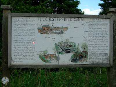
The coffee shop here seemed to be doing a fair old trade with walkers, cyclists and the boating fraternity, and I must admit I did fancy a coffee. However having just had my lunch I decided against. Of more urgent concern however was getting the umbrella out of my bag as at this point the heavens opened briefly. Now for some strange reason I had been under the impression that the Chesterfield Canal (which at this section is also part TPT and Cuckoo Way) was neglected and run down. Not a bit of it, as this was as nice a stretch of canal as you would find anywhere, and being a bank holiday I wasn’t the only one using it either. This was also a very long stretch as well, as from the coffee shop to the back of Chesterfield station was something in the region of three and a half miles. Along the way I passed the flats that I nearly bought into at Tapton Lock Hill, someone asking me how to get to Brimington, a smattering of fishermen, and a very inviting foody pub terrace on the other side of the water.

All good things however must come to an end as a half mile from the station with the canal now alongside the Hipper, the canal path went in two directions (one up, one down) both signed to the station. Naturally I choose the wrong one (assuming the higher path has to be better), as this looked like the sort of section where your average gangster would come to dump dead bodies (I think me and Helen did this section before). So it was with some relief that I came out by the back of the station still in one piece (the two bull-terrier owners I met coming the other way must have been having a slow day). From there it was a case of leaving the TPT intersection and retracing my steps along the Hipper and back home (again not the nicest section of the walk).
So overall I was very pleased with my efforts, coming in at just under 4 hours for 10.8 miles (including lunch) although without retracing my steps next time, this is probably around the straight ten mile mark. Next time I will try to go through Brimington Common to avoid that long housing estate, and also choose the up section on the last stretch of the canal towards Chesterfield station. Overall however as a bog standard door to door walk, this compares favourably with my Putney to Osterley one.
 Now much of what I was trying to do would involve a loop around the Trans Pennine Trail, however my first concern was whether there would be sufficient paths along the River Hipper to make an easy link to it. So having crossed the footbridge over the A61 (trying to snap the Crooked Spire in the process) and having met the inevitable bull-terrier and owner, I was able to find sufficient paths along the Hipper. However having arrived in the general vicinity of Chesterfield railway station, I only found the Trans Pennine Trail (herein known as TPT) sign in one direction. Knowing I was going in the wrong direction I started to follow it anyway, but when I eventually decided to retrace my steps, I spotted the opposite sign I should have picked up in the first place.
Presently I arrived at the entrance to Tapton Park Golf Course, with the TPT sign not really clear as to whether that led into the club itself, or along the adjoining road. After 5 minutes in a state of near paralysis, I choose to go into the golf club (standing out like a sore thumb as I walked through the car park with everyone unpacking their sticks). Much to my relief I found another TPT sign, and then another again. However with an unexpected fork (choice of paths) I was once again in a panic, and of course took the wrong path. Not wishing to be wandering aimlessly around a golf course, I decided if the other path wasn’t the TPT I was retracing my steps back home, in the event however it turned out that it was and things got easier from that point.
Now much of what I was trying to do would involve a loop around the Trans Pennine Trail, however my first concern was whether there would be sufficient paths along the River Hipper to make an easy link to it. So having crossed the footbridge over the A61 (trying to snap the Crooked Spire in the process) and having met the inevitable bull-terrier and owner, I was able to find sufficient paths along the Hipper. However having arrived in the general vicinity of Chesterfield railway station, I only found the Trans Pennine Trail (herein known as TPT) sign in one direction. Knowing I was going in the wrong direction I started to follow it anyway, but when I eventually decided to retrace my steps, I spotted the opposite sign I should have picked up in the first place.
Presently I arrived at the entrance to Tapton Park Golf Course, with the TPT sign not really clear as to whether that led into the club itself, or along the adjoining road. After 5 minutes in a state of near paralysis, I choose to go into the golf club (standing out like a sore thumb as I walked through the car park with everyone unpacking their sticks). Much to my relief I found another TPT sign, and then another again. However with an unexpected fork (choice of paths) I was once again in a panic, and of course took the wrong path. Not wishing to be wandering aimlessly around a golf course, I decided if the other path wasn’t the TPT I was retracing my steps back home, in the event however it turned out that it was and things got easier from that point.
 With my confidence back up, I was sufficiently happy to even leave the trail to take what I knew would be a more scenic short cut along the edge of Tapton Hall Farm, and subsequently picked up the trail again with a climb up towards Brimington Common. Having arrived at the common the TPT signs pointed initially alongside and then away from the common. However all this served to do was take me through a housing estate (thankfully not of the sink variety) for the best part of a quarter of a mile. When I eventually cleared that and crossed into Lodge Farm, another study of the map showed I could probably have got to the same point via Brimington Common.
I then picked up a nice woodland trail eventually coming to a fork that I had been speculating over before I had even set off. Thus having reached this point, I decided that continuing straight on the TPT would probably turn this walk into something approaching a 15 miler. Not only that but another look at the map seemed to suggest that section was going to be somewhat industrial and urban, therefore I took the left fork and headed deeper into West Wood. Here there seemed to be more paths to the left and right of me, then the map would suggest, however for the most part I tried to keep Trough Brook in sight and to the left of me, and when I eventually came to a larger pond (as shown on the map) I was sufficiently happy to then have my lunch. Being me however I choose to have it on some steps, when I later found there were some nice tailor made benches on the other side. Here I wasn’t entirely sure whether these manicured grounds were part of Ringwood Hall Hotel, or a continuation of Troughbrook Wood.
Thus having been forced out onto the road I then tried to find my way back into the wood (even though there was no signed path) to follow the brook further, rather than join the road. However after following a small trail of overgrown nettles, this only served to loop back on itself and force me back onto the road anyway. All a bit pointless really, as the road didn’t go on for long, and before long I was able to pick up the Chesterfield Canal (TPT again).
With my confidence back up, I was sufficiently happy to even leave the trail to take what I knew would be a more scenic short cut along the edge of Tapton Hall Farm, and subsequently picked up the trail again with a climb up towards Brimington Common. Having arrived at the common the TPT signs pointed initially alongside and then away from the common. However all this served to do was take me through a housing estate (thankfully not of the sink variety) for the best part of a quarter of a mile. When I eventually cleared that and crossed into Lodge Farm, another study of the map showed I could probably have got to the same point via Brimington Common.
I then picked up a nice woodland trail eventually coming to a fork that I had been speculating over before I had even set off. Thus having reached this point, I decided that continuing straight on the TPT would probably turn this walk into something approaching a 15 miler. Not only that but another look at the map seemed to suggest that section was going to be somewhat industrial and urban, therefore I took the left fork and headed deeper into West Wood. Here there seemed to be more paths to the left and right of me, then the map would suggest, however for the most part I tried to keep Trough Brook in sight and to the left of me, and when I eventually came to a larger pond (as shown on the map) I was sufficiently happy to then have my lunch. Being me however I choose to have it on some steps, when I later found there were some nice tailor made benches on the other side. Here I wasn’t entirely sure whether these manicured grounds were part of Ringwood Hall Hotel, or a continuation of Troughbrook Wood.
Thus having been forced out onto the road I then tried to find my way back into the wood (even though there was no signed path) to follow the brook further, rather than join the road. However after following a small trail of overgrown nettles, this only served to loop back on itself and force me back onto the road anyway. All a bit pointless really, as the road didn’t go on for long, and before long I was able to pick up the Chesterfield Canal (TPT again).
 The coffee shop here seemed to be doing a fair old trade with walkers, cyclists and the boating fraternity, and I must admit I did fancy a coffee. However having just had my lunch I decided against. Of more urgent concern however was getting the umbrella out of my bag as at this point the heavens opened briefly. Now for some strange reason I had been under the impression that the Chesterfield Canal (which at this section is also part TPT and Cuckoo Way) was neglected and run down. Not a bit of it, as this was as nice a stretch of canal as you would find anywhere, and being a bank holiday I wasn’t the only one using it either. This was also a very long stretch as well, as from the coffee shop to the back of Chesterfield station was something in the region of three and a half miles. Along the way I passed the flats that I nearly bought into at Tapton Lock Hill, someone asking me how to get to Brimington, a smattering of fishermen, and a very inviting foody pub terrace on the other side of the water.
 All good things however must come to an end as a half mile from the station with the canal now alongside the Hipper, the canal path went in two directions (one up, one down) both signed to the station. Naturally I choose the wrong one (assuming the higher path has to be better), as this looked like the sort of section where your average gangster would come to dump dead bodies (I think me and Helen did this section before). So it was with some relief that I came out by the back of the station still in one piece (the two bull-terrier owners I met coming the other way must have been having a slow day). From there it was a case of leaving the TPT intersection and retracing my steps along the Hipper and back home (again not the nicest section of the walk).
 So overall I was very pleased with my efforts, coming in at just under 4 hours for 10.8 miles (including lunch) although without retracing my steps next time, this is probably around the straight ten mile mark. Next time I will try to go through Brimington Common to avoid that long housing estate, and also choose the up section on the last stretch of the canal towards Chesterfield station. Overall however as a bog standard door to door walk, this compares favourably with my Putney to Osterley one.
No comments:
Post a Comment