With the mist taking its time to clear, my start from the Y Gryn basecamp was delayed until 10.30. So with that in mind I was thinking coldish day and therefore set off in: jeans, long top over t-shirt, body-warmer, and with only two (half litre) bottles of fluid. On all counts that proved to be a mistake, which would all cause me difficulties later. Now what looks like a reasonable path from the basecamp to the Storey Arms, is actually a long drawn out climb, which really becomes apparent when you look back on it. So by the time I had made it to the Storey Arms and the start of the ascent of Y Gryn, I had already stuffed in the rucksack the long sleeved top + body-warmer. What was worse was at this point (a mere mile and a half in), I already felt the need to consume a whole bottle of fluid.


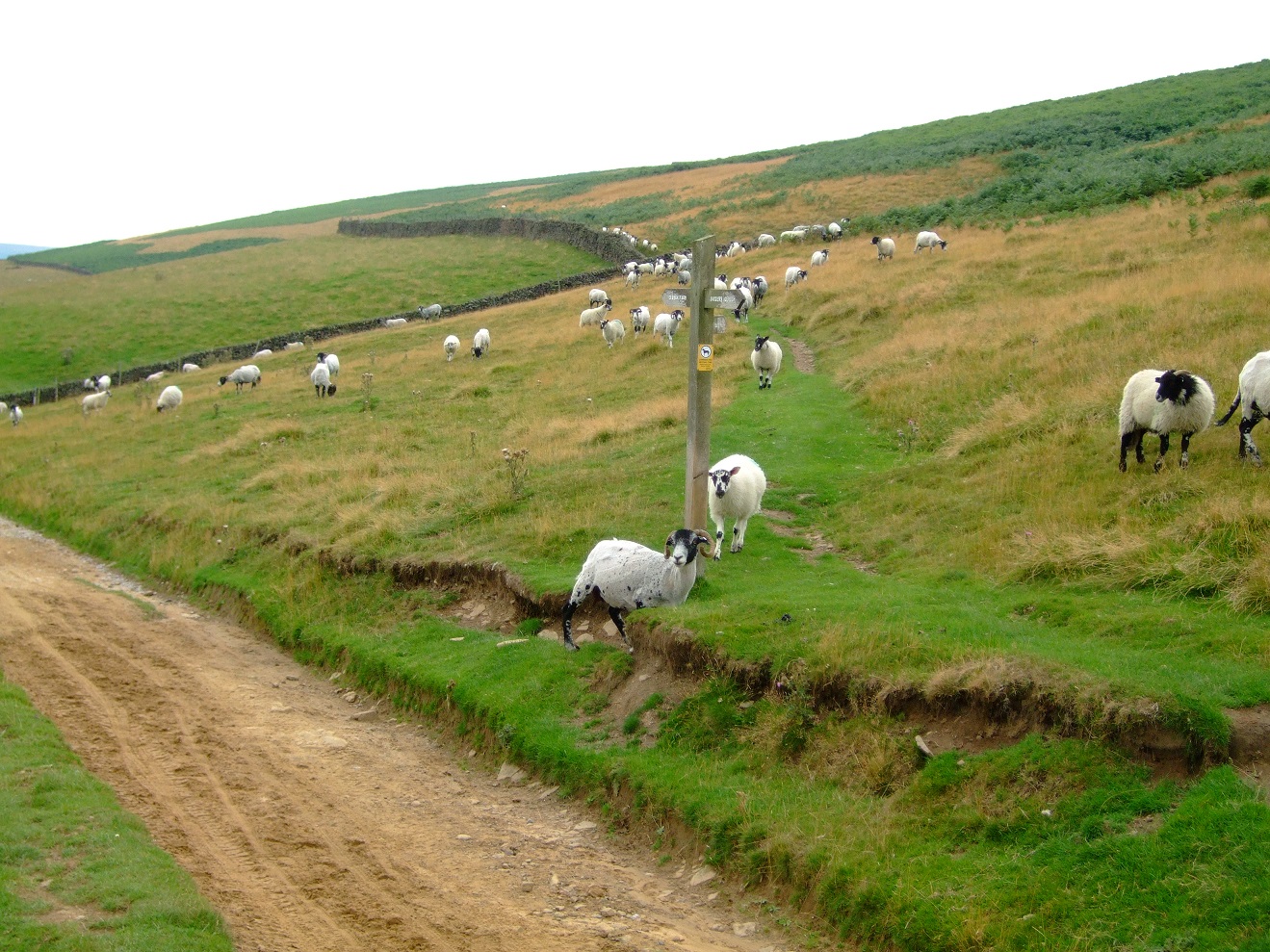
Anyway the actual ascent of Y Gryn began well enough when the party of school-kids took an alternative path to me. However with the clouds now following me up the hill, My path just disappeared, leaving me nothing but sheep tracks and my GPS to navigate with. The ground did get rather treacherous once I stepped off track, but eventually I found my way to a pile of stones and a stick, which I assume was the summit (given peoples penchant for nicking the National Trust signs).


So back on track I made my way over to the Craig Cwm Llwch ridge and the start of the ascent of Corn Du. As my regular readers know, nothing stresses/exhausts me more than being slightly lost, which made the already challenging ascent of Corn Du, even more of a struggle. However having reached the top (with cloud accompaniment) the down and up leg to the summit of Pen Y Fan was a real doddle. As the time had already passed One o Clock, I decided to have my lunch there rather than waiting till I was at the top of Cribyn. Given that Pen Y Fan is the hit single from the Brecon's album, I was joined up there by plenty of other people, including a small detachment of young soldiers.


With lunch out of the way, I took the stony path down, which would eventually take me up to Cribyn. To my right were two wild ponies snuggling up, and way in front was a walking couple on the same route as me. My ascent up Cribyn was a bit of a stop/start affair. However with the soldiers now in hot pursuit I made sure I got to the summit ahead of them. Thankfully I had already had my lunch, as my initial designated spot was absolutely crawling with flying ants, to near horror movie proportions. I decided not to hang round there admiring the view, and began my descent towards the reservoir complex. The soldiers obviously see flying ants in a different context, as once they reached the summit (now behind me), they decided to take a break up there.


On the descent I passed the walking couple, who were themselves taking a break and swapped a few notes with them over how to get into the reservoir complex, and tried to sound alarmist by saying "the army are right behind you". The male half of which made some crack about the 'Russian Army' which I later worked out was something to do with my CCCP t-shirt. Anyway having reached level ground below I was really able to get a head of steam on, which even the posse of now marching again soldiers couldn't keep up with. However once at the approach to the reservoir I had to pause for a few minutes to work out the right path, allowing the army to reel me in. 'Fine' I thought I will follow them, however once in the complex they promptly all sat down again for another break.


As I left the reservoirs and contemplated the forthcoming climb alongside the woods (and ultimately the climb up onto the ridge) I was caught by the walking couple. Once again we swapped notes with them saying they were taking the path on the right, with me saying my instructions said 'ignore the faint path on the right'. In the event they ignored the faint idiot on their left and carried on (on what was probably a much better way up). As I started climbing I became very aware of how dehydrated I now was, and how jeans could not have been a worse thing to wear in this peak heat of the day. After finishing the last of my fluid, the climb up alongside the woods nearly finished me off, with me pausing every few yards. As I looked back I could see the army was on the move again, albeit not much quicker than me. Thus having reached the top of the wood line, it was now onto phase two, namely the even steeper climb up onto the ridge. This was a complete man-killer with me even doubting whether I would actually get up there (with no actual visible path). Ultimately I made it, but from the bottom of the reservoir complex it must have taken me around 45 minutes for something I would have done in 10 in a straight line.

The view was of course magnificent, and I decided to take a 10 minute break and wait for the soldiers to go by. However once onto the ridge they headed off in a different direction. When I got to my feet again I began to realise how unsteady I was (not a good place to be, when you are on a ledge), and how desperate for water I was. So desperate in fact that I actually drank a three year old bottle of tap water that was for cleaning wounds in my first aid kit. However I kept reminding myself to savour the view and these moments (as they don't come round too often), and that I would get a big bottle of coke once down at the Storey Arms car park.

Once I began my descent from the Corn Du/Pen Y Fan junction I knew I was on the home straight, although some way down Pen Y Fan my bag zip burst open and I lost my long sleeved shirt. I only discovered this once I heard/felt my body-warmer fall out some time later. However I did not have the strength to begin climbing again to look for it. Now down in the car park at approximately 1720, I discovered all of the snack bars had either gone or shut for the day. However I wasn't too disappointed as I was only a mile and a half from the basecamp, with the thought of buying something motivation enough to get me off the ridge.

Now I did this walk a year back and it took me around six hours, so on this occasion I arrived back in the basecamp at 1745, so allowing for lunch it took me around seven. Given that it was 14 miles and that most of it was climbing, not too bad at all. That said from the moment I began to climb out of the reservoir complex I was in trouble, which made me realise how cavalier my preparations were. So in retrospect a challenging and enjoyable day, but without doubt the toughest walk I have ever done, and comparable to my not very successful efforts at the marathon way back when I was a runner.


 Anyway I eventually found my way onto Lovers Walk, on a steep stepped climb that had me looking back at the Heights Of Abraham on one side (cable cars too small to see in this photo) and Matlock Bath, with some sort of school holiday fun-fare way below. This soon descended in a switch back to the river Derwent, where I crossed a white footbridge to come out on the A6. There I followed the road past Masson Mills, regretting the fact that I had already had my lunch, before turning left to pass Cromford Mills. The visitor centre there had a board displayed outside for Bradwell's ice cream. Now this seemed a good idea, but the grumpy sod in the visitor centre told me there was no one to operate the kiosk (what looked like a standard fridge thing to me), and told me to piss off (well not his exacts words, but if you can read body language.....)
 Fortunately disaster was averted as there was an ice cream van, at the joining point of Cromford canal (also a conveniently placed set of conveniences). From here it was a fast and flat canal walk that took me to my first marker of Highpeak Junction. One thing that had come up in conversation on Monday's walk with Helen was the prevalence of Himalayan Balsam (invasive species) that seems to be everywhere. If anyone is looking for a good example of this, walk along the canal by Highpeak junction and you will get some idea of the problem.
 Anyway after taking some photos of the Wharf Shed and Leawood Pumphouse (see below), it was back with fast flat canal walking for the 4 miles to Ambergate. My written instructions, were a tad confusing regarding where to come off for Ambergate station (two stone bridges have a 'Welcome to Cromford Canal' sign), but having worked that out, I arrived at Ambergate with twenty minutes to spare for the hourly train back to Derby.

 Walks since last blog entry: Chander Hill-Chesterfield (circular) - Helen (Molly) - 4 miles


 Well having done this walk myself four days prior, the next thing to do was to bring the other half along for her evaluation. Molly the black labrador was also on hand to give this walk the once over. The verdict being that it was quite acceptable as a walk, which on this occasion was enhanced by the sunny weather, and the double foodie stops to consume Tesco sarnies and my latest (Victoria) sponge cake creation. So overall a keeper in my book, with lots of scope to develop the basic spine of the walk with additional loops and diversions
 Setting off from Grassmoor Country Park, my Five Pits Trail loop took me through: Williamthorpe nature reserve and Holmewood, before looping back on the Grassmoor branch, via a circular turn back at Timber Lane farm. The paths themselves were clear and physically undemanding. However being hemmed in by trees and bushes either side meant there was no real scenery or stunning vistas to look at. So basically a walk for a very hot day, when you want to be outdoors, but in the shade.
 WALKS SINCE LAST BLOG ENTRY:
(1) Linacre extended circular - 4 Miles & (2) Beeley / Chatsworth Dambusters flypast circular - 3 miles.
WALKS SINCE LAST BLOG ENTRY:
(1) Linacre extended circular - 4 Miles & (2) Beeley / Chatsworth Dambusters flypast circular - 3 miles.
 Anyway to get things moving again we (the Royal we doncha know) will start with a walk of 5 miles, that we have done before, only on this occasion we did bring a camera (Helen’s).