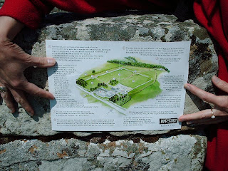
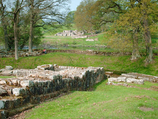
This walk being one of 39 organised over two days by Walk London http://www.walklondon.org.uk/ as part of their Spring Into Summer weekend. The actual walk itself being a 7.5 mile section of the 78 mile Capital Ring, and travels from Wimbledon Park (tube) to Richmond Station. At the end of which I carried on with the Capital Ring for another 3.5 miles, until I had reached Osterley.
A group of about 20+ walkers gathered at Wimbledon Park Tube for the 10.30am start, 4 of which were leaders of some sort. So having made our way into the park, we found ourselves being photographed by a local press man in order to publicise the (London wide) event. Everyone seemed chatty and happy to be there, none more so than our ultimate leader Jill, who as well as being an ultra 24 hour walker, is also some sort of Bat Warden (as if walking round the Isle of Wight coast for 24 hours didn’t make you enough of a super hero).
Having left the tennis courts and the hidden athletics stadium behind, we were soon out on the road which I recognised as part of the approach to the (not close enough to be visible) All England Lawn Tennis Club. However a diversion off of that and we were on Wimbledon Common, with its famous windmill. By the time we reached Putney Heath, it did start to look as if the heavens were about to open at any moment. Thankfully in the event not, with the only nuisance value being the Mountain bike fraternity and a few horses.
Having crossed the footbridge over the A3 we were into Richmond Park via the Robin Hood gate, where we cut straight across the park. This being a whole new and unrecognisable section of Richmond Park for me, as I have tended in the past to stick to the perimeters. The beauty of it being you are not being hassled by either motorists or cyclists (as is the case in some sections). We then stopped for some snacks upon a pile of logs, where leader Jill thoughtfully provided some Swiss Roll, for the likes of me who hadn’t brought anything along. While her husband and other leader Dave gave me a handy map of the whole 78 mile Capital Ring.
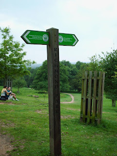
Then it was onwards onto Pembroke Lodge and what is the highest point of Richmond Hill, called Henry VIII’s Mound. There a telescope is thoughtfully provided free, and if you look through it at a gap through the bushes, you can see St. Pauls Cathedral. Apparently this was where Henry kept a look out for smoke from the Tower of London, to signal when Anne Boleyn had just had her breakfast ruined. Unfortunately even with the telescope’s help, none of us could see the Tower or Windsor Castle, which are also supposed to be visible.
We eventually left the park at the gate by the Dysart Arms pub and picked up a small path till we came to Petersham Meadows where other leaflets were handed out. Then it was onto the Thames Towpath in order to come off just after Richmond Bridge and the finish of the scheduled walk, with a few questions (for the TFL types who were sponsoring this) as to what did we like the most/least etc.
At this point I carried on alone along the towpath on what is still part of the scheduled Capital Ring. This involved crossing Twickenham Footbridge, and a few forced diversions in and out from the river, until I came to Syon Park. Having crossed through there, where some sort of posh wedding was taking place, I picked up the Grand Union Canal in Brentford, coming off at the Gt. West Road, and home for tea.
Incidentally I did take some more/better pictures than the two shown here, but like one of the days on Hadrians Wall, I inadvertently left the camera on macro, leaving the results in blurryvision.
Saturday, 31 May 2008
Wednesday, 21 May 2008
Hadrians Wall Path – Day 5 + Postscript – Walton to Carlisle – (Northumbria) – 14/05/08 – 12 miles approx – Helen
Day 5 and the Romans had left us. Thus unlike the previous three days there were no wall, turrets, milecastles or museums. As such we rounded the holiday off with a pleasant country walk in the morning, mostly through farmland, passing in the process Carlisle airport (post Roman), before having a light pub lunch at Crosby on-Eden. In the afternoon we crossed the M6 heading through Rickerby Park alongside the River Eden, until we reached Carlisle Football Ground (thankfully at home to Leeds the following night) and the end of our trail along Hadrians Wall Path.
Having reached the end of our line however there followed some minor confusion as to whether we were where we thought we were, followed by a hunt for our final (but full distance walkers penultimate) passport stamping point at the Sandy sports centre. That concluded we located our B&B, the most spacious room all week, before heading off to the local golf club for dinner, and back again for a final game of chess, and to watch Rangers in the UEFA Cup Final. A low key last day on a very enjoyable and interesting week.
POSTSCRIPT
There will always be a nagging feeling with me that we should have gone for the full 84 miles. You know it is just one of those irritating things, that when you explain to someone you have walked Hadrians Wall, you then have to start qualifying it by saying “well no I didn’t do the full distance and the reason is …..”
Certainly given the pace that we proved we were able to cross ground on day 5 (when there was nothing to look at), I know we could have done the full distance with ease, over the five days we had allocated to it. That however is the crux of the matter, as in the mid section between Chollerford and Walton there is just so much to look at, and look is exactly what we did. Yet even then we still didn’t have time to see two major highlights en-route, which were Housesteads and Vindolando.
What day 1 and day 5 of our intinerary showed however, was that outside of that mid-section there really isn’t anything there, and you are following a path where you literally have to take the trail makers word for it. So as such those two days justified for me not tacking on the Wallsend or Bowness-on-Solway endings just in order to claim one has walked a mythical wall and distance.
So if any of you are reading this and fancy doing the same thing yourself, you can use the holiday company Contours http://www.contours.co.uk/index.htm which we used, and who proved to be efficient at doing what they said they would. You can also make up your own tour intinerary with them allocating as many days you want to it. For my money however 5 days is probably the right time to spend. Unlike us however I believe you should either do the full walk of 84 miles, looking neither left nor right and just go for the distance. Or alternatively allocate your full 5 days to the section between Chollerford and Walton (which we did in 3), and really soak up that Roman history.
Finally to put Hadrians wall in its full historical context a good starting point is this Wikipedia link Roman Britain http://en.wikipedia.org/wiki/Roman_Britain (the week has certainly stimulated my interest).
Tuesday, 20 May 2008
Hadrians Wall Path – Day 4 – Greenhead to Walton– (Northumbria) – 13/05/08 – 8 miles approx – Helen
First stop of the day, within spitting distance of Holmhead guest house, was the ruins of Thirlwell castle which was built sometime around the 14th century. Its relevance to our tour, is that it was built exclusively from material pinched from Hadrians Wall. Apparently (and somewhat ironically) when the castle itself fell into disrepair, much of its stonework was pinched again by local farmers. Anyway suffice to say there really wasn’t much there to see or spend time on.
So off we trotted diverting into the small village of Gilsland where Meg of Megs café, provided us with coffee, cake, and sandwiches for later. I did think I overheard her mention to someone that there were 300 soldiers heading our way, however sponge cake can do funny things to you that time of the morning so I dismissed that as something she was talking about from last nights telly. Also around this time we passed the home of Jefficus (with shield on display outside), who apparently can be hired out as a Roman soldier to anyone who has a taste for that sort of thing. I must admit I felt a little sad about this, as the guy’s career options have obviously been severely restricted by virtue of his name.
So off we were again travelling past Poltross Milecastle, Willowford Roman Wall, Willowford East and West Turrets and best of all Willowford Bridge. This was in fact one of three bridges built on this location as the Romans tried to adjust to the changing course over time of the River Irthing. What I particularly liked was how much remains and stands comparison with the on site information plaque (which I hope the photos illustrate). Looking at the contemporary bridge that spans the river now, I couldn’t help noticing the amount of stones on the bed in the vicinity and wondered whether these were part of the first two bridges that were swept away ?
Another steep climb and another milecastle followed, as well as a fair amount of wall before we arrived at Birdoswold Roman Fort & Study Centre. I have to admit that of the the three museums/forts we visited this was the least impressive both inside and out, or maybe I was just getting a little museum/ruins fatigue. It was also noticeable outside looking around the fort, that despite the sunshine there was a biting chill wind if you stood around too long in it. Suffice to say we didn’t, and after more coffee and cake, we were back on the march.
Once on our way we came to realise that the 300 soldiers thing wasn’t a joke after all, as wave after wave of young squaddies came route marching towards and past us. They all seemed friendly enough though, and I think I heard later that they were marching the full 84 miles for charity in half a day (or something like that). Naturally we were on a slower schedule, which was just as well as there was still plenty to investigate en-route such as: Piper Sike Turret, Pike Hill Signal Tower, Banks East Turret, and Hare Hill.
Oh yes Hare Hill, where apart from another section of wall they have a slightly overhanging tree on the path that passes the farm of the same name. Needless to say yours truly (distracted by a cow pat) walked straight into it. I tried my best from that point on, to alarm Helen of the possible consequences of brain damage if my head swelled up later on in the day, which of course she was having none of. In fact so blasé was she about everything at that point, that walking through a field about six feet past the nose of a massive bull (minus cows in said field) held not the slightest concern for her. I took a different point of view on that one however, and decided (whatever the sign said) to take a serious diversion round that particular field. Partly because I was wearing a red shirt, and partly because I thought one bump on the head was enough for that day.
Our last point of interest as we were on the approach to our B&B was another piece of remains called Dovecote Bridge. There Helen met a really nice horse and they both agreed to keep in touch after the holiday. I on the other hand was getting a tad impatient for us to get to the B&B to answer a call of nature. Fortunately I was able to hang on the 5 minutes or so it took to get there, only to find the bastard place was closed. Thus no amount of banging on the door, phoning up landlines or mobiles, or eventually contacting the (nothing like this has ever happened before, call us tomorrow) tour company, could get the door open. Anyway remember that chill wind I was talking about earlier, well yes that was starting to kick in with a vengeance. A quick conversation with the sole human life form in the area (cutting his grass) established there were no other options, besides they had our luggage. However some 45 minutes after our first bang on the door, the B&B owner deigned to let us in, at which point she wanted to know did we want our ‘complimentary coffee’s’ outside ……..aaarrrrgggghhhhh.
Monday, 19 May 2008
Hadrians Wall Path – Day 3 – Steel Rigg to Greenhead – (Northumbria) – 12/05/08 – 9 miles approx – Helen
In walking terms the scheduled 8 miles was virtually a rest day, which in the event was extended to 9 by virtue of refusing a lift from the B&B back to Steel Rigg car park (well it was supposed to be a walking holiday). So the plan was to do all of the walking up to and around lunchtime, leaving the afternoon to browse around the en-route Carvoran Roman Army Museum.
There was a distinct chill in the air when we set off, and once we had picked up the trail from the car park, it was back to where we were the previous evening, with the best preserved sections of wall, the most rugged scenery, and an assortment of turrets and milecastles to investigate. Part of the post Roman history of the wall, is that over the centuries it has been systematically plundered as a source of free building materials for everyone in the region. It is therefore logical that the parts of the wall that are furthest away from civilisation (read the cities at either end, the B6318, and local farms), which also tend to be in the most inaccessible places, are where the wall is at its tallest, widest, and longest. So that was where we were currently walking.
Our first real objective was to reach the marked public convieniences at a car park in Cawfields. Thus having reached Cawfields milecastle 42, we found ourselves being greeted by a very friendly cat. We exchanged the customary greetings with it, explaining in the process that we didn’t have any food, and then wandered up the very steep stepped elevation, that was part of the milecastle. To our surprise the cat decided to then come up the stairs and join us. Not quite knowing what to do then, we gave it a few more strokes and came back down, all the while watched by our new feline friend from its lofty vantage point. Perhaps it was trying to tell us something ?
Onwards and often upwards we continued, at one point debating whether the dry stone walling we encountered to our left in a local farm, was really the hidden fort that was marked on the map. Although most of this section was continued as part of the walled elevation. Not for the first time we wondered that given the sheer drop to the North in these parts, was it really necessary to build any defensive wall here at all. Anyway by the time we found somewhere to stop for an outdoor cup of coffee, passing by a surplus of park rangers, it was early afternoon and we were virtually at Carvoran Roman Army Museum.
The museum itself was far superior to the one at Chesters the previous day, not least for the 20 minute CGI driven film about how the wall looked and operated back in AD122. The premise being that this was being seen from an eagle’s eye (or helicopter’s), which Helen admitted had made her feel dizzy. In my case however it managed to send me unintentionally to sleep (I did manage to stay awake for the second viewing though). There was also another film intended to be a recruiting clarion call for the Roman army (although it was not made clear whether this was original footage or not), as well as the usual posters, pictures and lifeless dummies (but enough about the gift shop and its staff). Also making its presence known in the museum was a very loud, know it all American kid, with his entourage of parents and siblings. Although I did try and see if there was a Roman sword within handy grabbing distance, nothing suitable was in reach, and the plastic gift shop ones would probably not have been up to the task I intended.
So not too late in the afternoon we arrived at Holmhead Guest House confusingly by the back entrance. Now this was definately the most unique B&B of the whole holiday. Helen wasn’t impressed by the fussy pink frillyness of the bedroom, and for my part I found the bathroom shower arrangement somewhat unusual. However unlike anywhere else there was a large common room for all the guests (which we had to ourselves) stuffed to the gills with magazines/books/photos/collectibles of all things: Hadrians Wall, country walking, and tourist Northumberland. The real surprise however was the three piece meal that ended up being set before us. Host Pauline and her staff, really cook to Gordon Ramsey standards, and it was without doubt one of the best meals I have had in years. Be warned however whilst the prices are not quite what you would pay at Gordon Ramsey’s, it is as well to check your Visa’s credit limit before you let her indulge you (not a problem for me on this occasion however, as it was Helen’s turn to pay).
Saturday, 17 May 2008
Hadrians Wall Path – Day 2 – Chollerford to Steel Rigg – (Northumbria) – 11/05/08 – 13 miles approx – Helen
After the scarcity of Roman wall or otherwise on the previous day, we had only to go to the top of the road on day two, before stumbling across our first visible (Brunton) turret remains on the tour. Also unlike the cows on the previous day, the sheep in this field were clear that we could stay and look for as long as we wanted. Unfortunately we couldn’t stick around for ever as our priority was to locate a garage shop (which according to the manager at the B&B was just down the road), in order to stock up on vital provisions for the day. When we did come across said garage, it quickly became obvious that it had closed it doors to business, probably not long after the Romans had departed from the region.
Undeterred we pushed on towards the roundabout, only to come across a 1km diversion off our route in order to see the Roman remains of Chesters Bridge that crossed the River North Tyne. Suitably impressed we walked back up to the roundabout and today’s bridge that crosses the river, only to stumble across a small café where we could replenish our stocks. So two Cokes, two bags of crisps, two Mars bars and an ice cream, all for just over three quid, either represents a good deal for the walking consumer, or the young girl serving hadn’t quite got the hang of the till (no idea what Helen paid for her sensible sandwich by the way).
We walked on, yet even whilst my ice cream was still a recent sticky memory, we had reached the entrance to Chesters Roman Fort and Museum. As is to be expected the English Heritage lackeys weren’t content to just sell us a ticket, but also wanted us to take out lifetime membership as well, but we politely took their leaflet instead and said we would think about it later. Inside the museum itself was a large number of stone engravings as well as the expected exhibits of pottery and coins. Outside however was the real deal, with the visible remains of the cavalry fort, with separate barracks, bathhouses, and commanding officers quarters. What was really exciting though, was when we realised (a bit slow you see) that we were now standing on the opposite side of the river to Chesters bridge that we were looking at earlier, and which was of course the link road to the fort.
Upon leaving the fort/museum however it suddenly struck me that it was now quarter to midday, and that in effect we had only covered 1 mile, with another 11 of the planned route still to do. Thus I spent the rest of the day acting as some sort of Roman Centurion eager to cover the open ground quickly, whilst Helen played the part of a rebellious slave girl determined to go at her own pace, stopping whenever tired or hungry. To be fair however it wasn’t just the rebellious slave girl, that was holding things up, as this was where the the whole thing started to really come together. Thus the more the gap widened between us and the B6318, the more turrets, milecastles, temples and sections of wall there was to stop and look at. We also started to be more aware of the North ditch (even in the absence of Wall), the South Vallum (another series of ditches designed to protect the troops from cattle rustlers and the like in their rear), and the near parallel Military Road. The view Northwards was also getting ever more impressive.
Despite a minor incident (that potentially could have wrecked the holiday) when a wasp conspired to get between my glasses and my eye, things were going well. That is until we came to a small farm in the Sewing Shields region. Here we found ourselves faced with a choice of about three different routes, at the one point of the whole path when the sign posts had mysteriously disappeared. Thus just as we were trying to concentrate we found ourselves assailed for several minutes by the smallest and noisest of dogs, who was determined to make all and sundry aware that there were walkers in the region, who may be cutting across the farmyard (fuelling my suspicions as to whether there orginally was a sign, which had been disposed of). Needless to say this wasted a fair chunk of time, with us having to ask three different people (on assorted Quad bike’s, Range Rover’s or Horse’s) before we eventually got back on track.
So although we were very close to Housesteads Fort, which was intended to be one of the walks major highlights, we were still three long climbing miles from our finish point. It was therefore decided that we could come back on the bus for that one the next day, or maybe the day after (in the event neither). Past Housesteads however, and past the link with the Pennine Way, the full frontier majesty of the wall and the sparse country it was defending really came into its own. Thus despite the fact that we were now tired, hungry, getting colder and facing one gradient after another, this particular stretch remains my own personal highlight of the whole 5 days. The photos here of the wall and yet another milecastle, cannot do it full awe inspiring justice.
After coming across a series of young unlikely walking sorts (one carrying a guitar) we guessed our finish point at Steel Rigg car park must be nearby. Thus we were grateful when our B&B host came and picked us up from there, rather than let us walk an extra unwanted mile. That is what I call service, although I suspect it was hidden somewhere in the evening’s dinner bill the following morning.
Friday, 16 May 2008
Hadrians Wall Path – Day 1 – Heddon on the Wall to Chollerford – (Northumbria) – 10/05/08 – 15 miles – Helen
You all know about Hadrians Wall of course. Built by the Roman Emperor Hadrian, over a ten year period from AD120, to keep the Scots and other bad sorts out of the North of England. As such it represented the very furthest point of the Roman Empire, with the emperor himself visiting it in AD122 (by some incredible coincidence there is now a bus with that same number that travels the whole route).
Now the first thing to mention here, is that we opted not to do the full 84 miles of Hadrians Wall (more of that in the postscript) but rather to do a ‘Best of’. This meant leaving out the Wallsend start in Newcastle Upon Tyne, and the Bowness on Solway finish. Our stretch over 5 days would therefore total some 55+ miles.
So after an overnight B&B stop in Wylam (en-route to which, we stopped and took in the Angel of the North) we set off through the car park of the Three tuns pub, almost managing to lose the path at the very start. Now Heddon on the Wall is where the wall apparently begins in earnest. Well you could have fooled me, as for the entire day this was not so much the Hadrians Wall path but rather the B6318 path. That is not to say walking slightly off the open road on a bright sunny day was unenjoyable (Helen commenting how much she enjoyed the yellow fields of fresh rape). However one was reduced to clutching at straws as we wondered whether any of the roadside dry stone walling was really …… well you know ?
As I said though the weather was good, and after a handily placed roadside burger van provided us with some morning refreshment, we passed through the Whittledene Reservoirs, and on to our first (but full distance people’s second) passport stamping point at the Robin Hood Inn. Naturally that provided the opportunity for more liquid refreshment, which was enough to keep us going until our lunch stop on the edge of a small farm. Having set off again however, it became apparent that another walker with a map was shadowing us, stopping whenever we did. This did start to get a little creepy and obvious. However a crafty boot tying exercise forced him to overtake, and that was the last we saw of him.
A late afternoon pub stop by Portgate roundabout, was soon followed by an encounter with two female walkers coming the other way, who were walking to our start point, from our finish point one night further down the line. Needless to say we paid homage to their superior fitness, whilst they chided us for not going the full distance. Once departed however, we decided that they might as well be walking anywhere, as they obviously wouldn’t have time to stop and look at anything around them. Which of course couldn’t be said for us, as our next sightseeing venture was St Oswalds Church (named after some medieval Christian sort). All very interesting I am sure, but hardly anything Roman.
Then just as we were coming to the end of our day it suddenly happened, with Helen being the one to spot it first. Namely a genuine chunk of wall (called Planetrees) just sitting in the middle of a field. At last a real photo opportunity, and confirmation that we were actually on the walk we thought we were on. Over the next three days at least, such sightings were to become ten a penny, but on our first day we determined to make the most of it, well that is until some grumpy cows decided it was time for us to be moving on.
Our pub B&B turned out to be reasonable, well that is once we were given a replacement room, after the first one was completely full of flies. Okay there was no en-suite (with us having to cross the corridor to Fly Central for our ablutions), separate beds, and only one towel between us. Oh yes and the milk at breakfast was off as well. However my sausage and mash for dinner was nice, and we did have a better view with our new room.
Tuesday, 6 May 2008
Curbar Edge to Upper Burbage to Padley Gorge – Peak District - Day 2 - (Derbyshire) – 04/05/08 – 13 miles – M&M IVC.
Unfortunately the morning started at the YHA with a bit of horror story. Thus two of our party who had forsaken the delights of YHA accommodation for a very local pub’s B&B (to avoid any liable claim you will have to work it out for yourself), had apparently received a very aggressive reception when popping up for breakfast. I wasn’t there so can’t really comment, except to say that after some later rearranging of mattresses, Bretton YHA found itself with two extra residents.
Our walk started with a drive to Curbar Edge, a stunning elevation which sweeps over the River Derwent. The other thing starting around that time however was the rain, with on and off waterproofs becoming a consistent feature of the day. Lunch consisted of a very early stop at Longshaw tea rooms (eating outside in the rain I hasten to add), where if the local sheep are not close enough to be seen, wooden ones are thoughtfully provided (pictured).
Suitably sustainised we moved on to Upper Burbage Valley and yet more stunning views. Something of a rocky climb later and we were on top of an outcrop dating back somewhere between 2500 and 3500 years ago called Carl Wark. Apparently this was once considered to be some type of hill fort but that is now considered unlikely. There then followed something of a lively discussion concerning what was the correct and safest way down (slippy wet rocks not helping matters) before we were on a way again and competing factions converged below. It was then on to Padley Gorge and subsequently Haywood, skirting past my old Grindleford stomping ground, only stopping at various forks in the road, so that our leader Alan could catch up and tell us which way to go. After yet another encounter with a lady on a horse, this time for once someone else not being sure where they were going, we eventually made it back to the Curbar Edge car park, having long since given up on putting the waterproofs back on or off.
The weekend was bookended on the Monday, with a 3 mile walk with Helen along the Lineacre reservoir/s on another perfect and sunny day.
Bretton Circular – Peak District - Day 1 - (Derbyshire) – 03/05/08 – 14 miles – M&M IVC.
This weekend of walking with Mountains and Moorlands IVC was officially due to begin on the Saturday. However as Grindleford rail station is some 4 miles away from Bretton youth hostel, and there are no other public transport links installed, early Friday evening found me lugging my full kit some 3 miles up the not so gently undulating Sir Willam Hill Road (my thanks to the friendly local who at least gave me a lift for the first mile). Overall as good an aerobic test as I have had for several years now.
The Saturday walk began from the YHA (pictured) on a fine morning, which turned into a lovely Spring day. As is usual on these things there was the usual round of conversation interspersed with stopping for pictures. Early on our travels as we traversed one of many peaks, we came across some sort of beacon/transmitter which I am convinced then followed us around for the rest of the day. After an encounter with some small (unsupervised) girls on ponies, we eventually settled for a lunch spot sitting on the broken section of a dry stone wall.
Early afternoon found us passing the Derbyshire and Lancashire Gliding club, trying to figure out both: why the gliders above us were merely going round in small circles, and what exactly were they dropping from below small red parachutes. So whilst still pondering all of that, we found our way into Great Hucklow, coming across a monument known as The Great Hucklow Cross (pictured). This was of such infinite fascination to some of our group, that while the rest of us wondered down to the pub for some vital rehydration, they managed to lose touch with us entirely. Some frantic phone calls later, they managed to track us down, but not before adding a mile to their distance for the day.
There was then another stop, this time for ice cream somewhere in Foolow, before heading for Eyam and a very steep climb in site of the same (or maybe perhaps another) transmitter to eventually pick up Edge road. This one joining up with Sir William Hill Road (yes that one), before passing The Barrel Inn, and back to basecamp. Overall a very enjoyable 14 miles.
Subscribe to:
Posts (Atom)