Monday, 30 July 2012

Cordwell Valley (Circular) – Derbyshire – 28/07/12 – 9 Miles (approx) – Helen (Molly)

A perfect summer’s day found us out and about on an almost local walk (taken from the August 2009 issue of Country Walking), which began for us at Barlow church. Thus the scenery throughout the day showcased for me what I like most about walking, but juxtaposed with this were problems with the route directions and the occasional cattle gauntlet, reminding me what I like least. So having found our way to Barlow Ponds, we walked along on a parallel path in the woods above them, before our first confusing instruction halted us at a lane. However after eventually working that one out we soon arrived at a long series of fields full of young male cattle that the instructions told us to go through, rather than use the bridleway that ran alongside it. This seemed totally silly to me (somewhat influenced by my dislike of all things bovine) so I carried on walking along the bridleway until I had outflanked them, and then joined Helen and Molly in the field. Time was also moving on at this point, so we briefly stopped to have our lunch. Having emerged in Cartledge, and picked up the sign to Unthank we crossed over three stiles and three fields, running the gauntlet of some more cattle (who always hang around stiles) as well as admire some large round straw type things that seem to appear this time of year. Somewhere in all this Helen lost Molly’s lead and so we had to improvise with a few bits of string that were lying about. Picking up a lane that was also signed Unthank I led us into a field (full of this time docile cattle) as I thought the instructions told us to do this on the sharp bend, whereas in fact the words were ‘after the sharp bend’. Everything seemed fine and dandy for a bit, but by the time we ended up by a brook (where Molly had a refreshing drink) we realised we were off course again. However with two great minds on the case, we were able to find an alternative route to Moorhall where our route was scheduled to continue. Once there however I struggled to pick up the instructions again, wasting time wandering about, whilst Helen had already figured it out. Back on track again we followed a walled track to Barlow Grange, before giving way to a tractor and beginning a long bridleway descent to Oxton Rakes. This was the highlight of the day for me, with fantastic views to Sheffield on our left and (more importantly) Chesterfield with its crooked Spire on our right. Once at the bottom however it all turned pear shaped again thanks to the rubbish instructions. Thus having taken three different options to try and make sense of it, with the compass also telling us we were going in the wrong direction, I was ready to throw my toys out of the pram. However Helen took charge with her OS map and eventually found us a path to take to Newgate (including crossing more dodgy cattle), which then took us on our way back to Barlow church. Walks since last blog entry: Kew Bridge – Richmond Park – Syon Park – Grand Union Canal – 13 Miles (approx)

Wednesday, 4 July 2012

Kildale (Circular) – North Yorkshire – 27/06/12 – 6.5 Miles (approx) – Helen (Molly)

Having slightly missed our intended start point, due to a gate we weren’t sure about going through, we eventually parked somewhere in upper Kildale. This turned out to be perfect as it took us on a nice gentle climb up to Captain Cook’s Monument. Unfortunately the weather wasn’t sure what it’s intentions for the day were, so on a couple of occasions on the climb we put the waterproofs on and off. Once at the monument the weather decided it was raining after all. So it was agreed that this was as good a place as any to have an early lunch, due to the monument giving us some bit of shelter. From there the view of our later objective, Rosebury Topping, came in and out of the mist. Once eaten we descended towards it and arrived at a car park at Cribdale Gate. A short climb later and we found outselves on a long trek towards Rosebury Topping with a wall on our left. Here the rain decided to chuck it down a bit harder, however by the time we passed through a gate, meeting another couple who seemed a bit off-route, the weather dried up. . The climb to the summit was actually shorter then it looked but quite sharp with it. Once up there and sitting on the edge we looked towards what we assumed was Middlesborough, whilst not looking down too much lest it induced vertigo. Having descended, and met and mutually ignored a group of ramblers at our earlier gate, we turned left picking up the Cleveland Way again. During the course of which we were buzzed by a low level fighter. Then an elderly walker with his black lab gave us some directions, at yet another Pillar box (Germans in North of England invasion horror). . A long and muddy descent towards a farm followed by a very steep climb up a road which took us back to the car. The weather meanwhile was improving all the time, thus by the time we drove over to Saltburn for a run about on the beach, it was a beautiful summer afternoon.

Tuesday, 3 July 2012

Ravenscar (Circular) – North Yorkshire – 25/06/12 – 8 Miles (approx) – Helen (Molly)

Following a brief look into the National Trust information centre at Ravenscar we picked up the Cleveland Way with our half way destination, Robin Hoods Bay, clearly visible. The path was somewhat muddy/slippy at this point but: the view was breathtaking, the sounds of the Sea and Gulls soothing, and the air was a fresh and salty tonic. After passing some sort of Pillar box (will those Germans ever give it up) we eventually worked ourselves down onto the beach. Molly was having a whale of a time, whilst not entirely sure what to make of it. There was also a certain amount of slippy stones to navigate, so we didn’t end up separated from the beach by more inland water. . Presently we found ourselves at Robin Hoods Bay (you know, the one where Wainwrights Coast to Coast starts or finishes). Here the priority was to get lunch, but found a lot of what might be on offer was shut due to it being a weekday (in June ?). Anyway we eventually picked a cafĂ© where we had two x fish and chips and one glass of apple juice, which was 40p short of twenty quid (staycation anyone). What made matters worse was that it looked like one portion of chips had been shared between the two meals. So following an ice cream from the van on the beach we set off back towards Ravenscar again. My energy levels had severly dipped at this point, either due to dehydration or the recent exertions on the Brecon Beacons. Anyway soon after lunch I needed a twenty minute kip on a bench. That didn’t necessarily revive me, and I did struggle along our return. This was exclusively on a disused rail track, taking us all the way back to the car. Along the way Helen bought some Thyme from the honesty box at an adjacent farm, and I got upset with my GPS after it appeared to switch itself off for no reason

Monday, 2 July 2012

Houlsyke (Circular) – North Yorkshire – 23/06/12 – 8.1 Miles – Helen (Molly)

Our first full day in North Yorkshire found us doing an afternoon door to door walk from our rented cottage. The idea being to circumnavigate the great big hill/mound (apparently known as Head) that was in the valley below us. This involved a certain amount of road walking, passing Little Fryup and Great Fryup before picking up a path by/through Crag Wood and Danby Crag, on what was an unsettled and variable day. This was not a walk without incident. Thus we found ourselves being hassled/intimidated by two separate groups of cows. Also: Molly bashed her head chasing a rabbit, Helen lost her coat and had to retrace her steps to find it, and we ended up having to do a ridiculous scramble when a OS marked path failed to materialise.

Sunday, 17 June 2012

Beacons Horseshoe – (Powys) – South Wales -13/06/12 – 14.5 Miles - National Trust Working Holiday

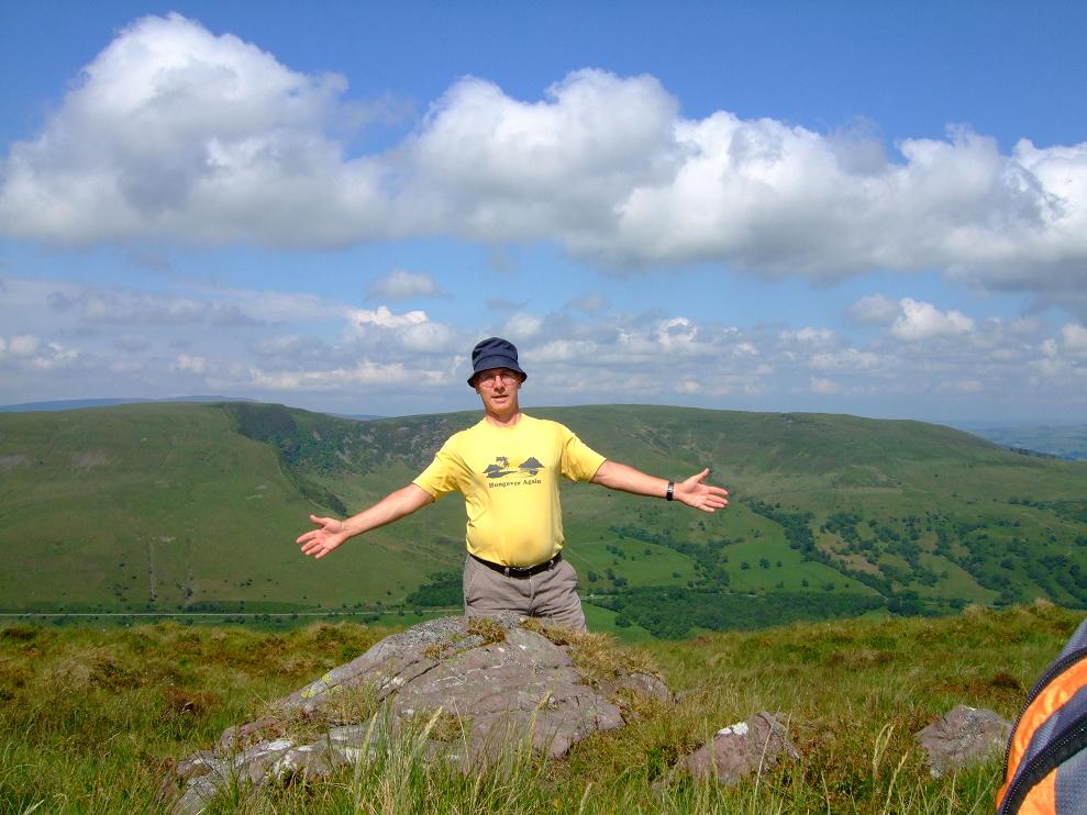
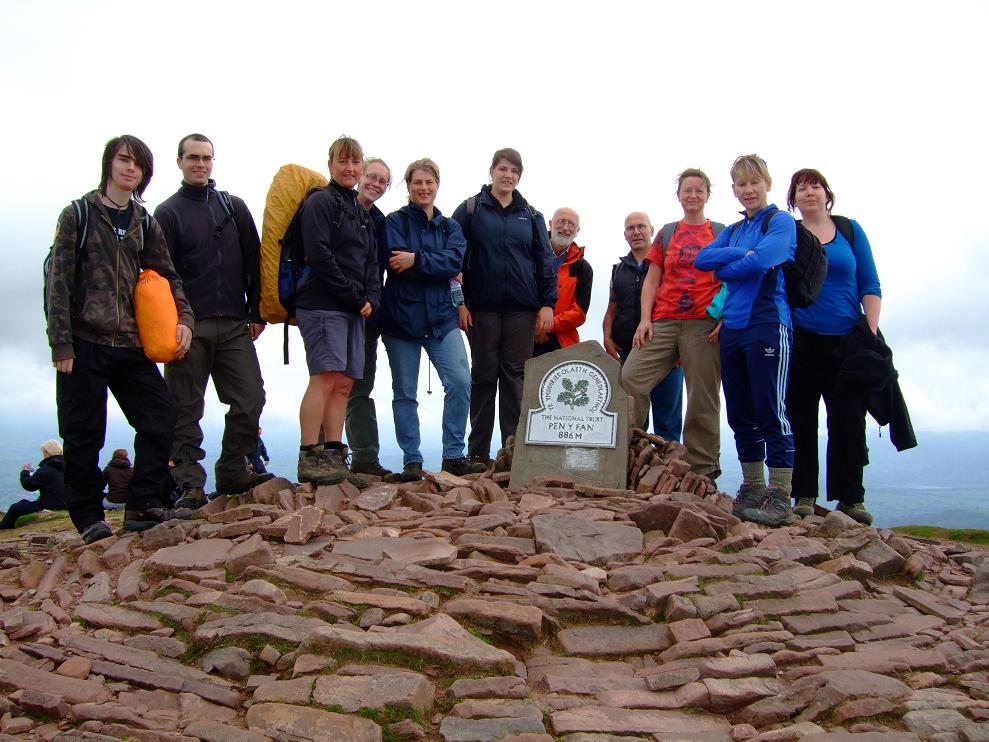
With everyone else on the Working Holiday opting to go canoeing on the day off, I decided to take advantage of a route cut-out I had brought with me for the holiday. So before you ask, no I wasn’t being anti-social, it’s just that I don’t do water. At the time I wasn’t overly happy with a long walk option (as the walking and working of the week was catching up with me) but the only other thing on the table was to go book shopping in Hay. So with that in mind I was thinking of potential drop out points if it all got too much, but on a beautiful sunny day none were required. .... Now the start point for the walk (as per cut out) was the Storey Arms (outdoor centre or snack bar), which in total measures 11 miles. However the walk from the basecamp along the Taff Trail to the Storey Arms came in at 1.75 miles on my GPS, so with the return from there factored in as well, this would bring the total mileage for the day to 14.5 miles. The start from the basecamp along the Taff Trail proved steeper than anticipated, but apart from four sheep who were constantly running away from me, and a cow and a calf being herded by a warden on a quad bike, I got to the Storey Arms without incident. Thus following the instructions, I ignored the stone trail to the left of the houses that went up to Pen Y Fan, but instead took the far less distinct grass trail to the left of it. Yet despite this being more guesswork than visibly marked route I soon found myself on the somewhat flattish summit of Y Gryn. Following a wide sweep to my right, still following an indistinct grass trail I eventually picked up the Craig Cwm Llwch ridge (passing in the process the Tommy Jones Obelisk). This was the approach to the summit of Corn Du. Oh my my was it steep or what, and despite the incredible views I was taking in, this was easily the toughest climb of the week (until later in the day). However by taking a simple one step at a time approach I eventually reached the summit. . A short dip from Corn Du, and then a short climb again, found me on the summit of Pen Y Fan for the second time in a week (the other three climbs during the week, took a diversion around the edge). Anyway I found some guys up there already, so persuaded one to take my picture (see picture). After hearing one of them phone his missus, I decided that was also a good idea and checked in with the Derbyshire lady. . The descent from Pen Y Fan was very loose underfoot, taking me down into a valley. I took the path to the left (as instructed) to begin the climb up to Cribyn. This looked very very steep, but as the instructions suggested, it was easier than it looked (just). Once on the summit I decided to have my lunch, especially given the fact that no one else was around. A gentle but not particularly easy descent took me along Craig Cwm Cynwyn until I reached the path junction at the pass of Bwlch ar y Fan. . From there I continued for two kilometres on a wide and descending path towards the Neuadd reservoir complex. Along the way I met two soldier types coming the other way and passed a cyclist sorting out his bike. By this time I had been aware of another guy coming up behind me, and when I went into the reservoir complex, I met another group of four guys having a break. Thus with various gaps between us all, we climbed up by the woods at the end of the dam wall, which took it out of everyone. However the final part of this turned into a man-killing scramble, which although didn’t last long, was almost equal in difficulty to the earlier ascent of Corn Du (anyway I was fourth up out of six). . Once up on the ridge however, things were easy peasy, as I headed along the long ridge towards the plateau below Corn Du and Pen Y Fan. The views were incredible, and I periodically took the odd break, whilst the other guys around caught me up and passed me by (before I did the same again to them). Once I arrived at the plateau (on my own) it was then a case of doing the descent I had been doing all week back to the National Trust car park. By now the skies had begun to darken, but thankfully the rain held off. I then continued on to the Storey Arms, passing in the other direction two of the guys from the ridge (who had since come down Pen Y Fan the other way). After a quick exchange of words, I then saw the other two of their group coming down the stone path, so I gave then a quick wave, to which they responded. .... From there it was then along the now descending Taff Trail back to the basecamp, passing some wild ponies on the way, and of course plenty of sheep to complete a brilliant day overall. Once back in the early Eighties I ran a half marathon in the afternoon, went home for an hour, then went and did a two hour Karate class. So given the context of the week overall, this rates up there with that (not bad for a fifty year old, even if I do say so myself) (NOTE SAME PARAGRAPH PROBLEM USING I.E. - ANY IDEAS ANYONE ?)

Saturday, 16 June 2012

Pen Y Fan (x 4) – (Brecon Beacons) – 10-11-12-14/06/12 – National Trust Working Holiday

Back in 2003 it was my first National Trust (conservation) Working Holiday that got me into walking, so periodically I have liked to keep my hand in, by doing the occasional one. However for various reasons I haven’t been able to do any for over two and a half years. Now they can be very hard work, and especially so in this case. Because this one involved walking all the way up to Pen Y Fan from the National Trust car park (not the Storey Arms one), then starting a day’s work lugging rocks about, before walking back down from the summit at the end of said day. The relevance of the work for the purposes of this blog, was that we were doing an ancient stone laying procedure known as ‘pitching’, designed to restore the pathways and gulleys leading from Pen Y Fan, that have been eroded in the main by (yes you’ve guessed it) us walkers. So beyond the point that it’s great to give something back, I won’t go into that aspect much further here, as this is primarily a walking blog. Instead I will make a few brief notes on those four climbs. Sunday 10th – Our first day found a group of 10 volunteers and a couple of Nat. Trust wardens set off from their car park. The idea being that we should be up to the work site in under an hour. However a combination of general faffing about, giving the slower ones a chance to get their breath, and admiring the views (which included a Red Kite), meant it was about an hour and three quarters before we got to the point where we started any work. The fact that it was such a clear day (forecasters wrong again) meant that things were being pointed out to us by the head warden, that may not have been visible on another occasion. Also if we were going to be working on Pan Y Fan, we all needed to get some pictures at the summit, which delayed proceedings as well. Naturally we all found the ascent at the end of the day a dam site easier. Monday 11th – When it came to the start of the second day I felt completely wasted. A combination of the previous day’s climb, carrying rocks about, and just the general effort of working on a slope, meant I felt weak in both legs and arms. Now our group was slightly smaller as three of the more enthusiastic types were taking an alternative route from the Storey Arms car park. We were also missing our leader who had returned to pick up someones lunch, but had given me her awkward and progressively heavier cake bag to carry up with me. Thus when our group went up the ‘standard’ route, I felt my best bet was to push on ahead of them, in case I ended up being left behind by the slower pace (finding as normal for me, a faster pace easier uphill)........................................................................................ For this morning however, a dense fog had descended on the mountain from a very low level, which meant I was able to keep ahead of the group, constantly stopping to take breathers, whilst making them think I was much further ahead than I actually was. The fact however that I couldn’t see anything other than the fog and the path about 10 feet in front of me, was mega-demoralising making me feel I wasn’t getting anywhere and that I would soon be caught. In desperation I eventually asked a guy coming the other way how far was I from the summit, to be told about 30 metres. Anyway when I reached the plateau at the base of Corn Du and Pen Y Fan, I decided to wait there for the others to catch up (pretending I wasn’t sure which way to go in the fog), whilst taking a few munchies out of the cake bag in order to make it lighter. Presently I was joined by the main group, closely followed by the other three from the alternative route who had encountered their own problems in the fog. By the early part of the afternoon the fog had completely lifted which made for a clear descent.............................................................................. Tuesday 12th – There was no mist on this bright clear day, which was reflected in my general well being, as my energy levels had risen considerably from the previous day. Now a number of our group were taking advantage of a lift from the warden in some sort of off road vehicle, about half way up, leaving six of us to make the actual ascent from the bottom. We were not alone however as the army were also coming up behind us, with two of their fitter types just in front of us. They could not have been amused however when the female running fanatic in our group, jogged past them as if they were standing still. For the rest of us, three of us got to the Corn Du/Pen Y Fan plateau before the rest of the army group, with them only just swallowing up the two slower members of our party. They all proceeded to collapse in a heap in front of us, giving us a grudging acknowledgement before setting off again (although to be fair they were carrying full kit, some heavy guns, and were no doubt just starting their workout for the day). For our part timewise, we had got to the plateau in about 45 minutes. Thursday 14th – Having done 14.5 miles of the Brecon horseshoe on the previous (rest) day (see next blog entry), I was concerned as to how my legs would feel. In the event they felt great and I flew up the hill for our last day of work on Pen Y Fan (the weather was too atrocious to work up there for the next and final day of the holiday). However having done a full days work, both the rain and especially the wind closed in with a vengeance. Thus coming down from the edge of Pen Y Fan (which was the standard route to our work site), one could barely keep ones feet as the wind tried to blow us all off the mountain. However once we had finally got below the plateau things eased considerably. With the Warden already forewarned as to the weather conditions arriving the next day, we all knew that this was our last day on Pen Y Fan, which everyone seemed a little sad about. However in my next blog instalment, you can read about my trek on the Brecon Horseshow which I did on the previous day (which was our day off).............................(ALSO APOLOGIES - BUT THE NEW FANGLED BLOGGER IS BEING A PAIN IN THE BUTT, WHEN IT COMES TO BREAKING TEXT INTO PARAGRAPHS)

Tuesday, 5 June 2012

Chesterfield (Trans-Pennine Trail) Circular – (Derbyshire) – 04/06/12 – 10.8 Miles

I must admit I am not one for using OS maps to create walks (much prefer other people to do that for me). However with my personage moving ever closer to full time living in Chesterfield, creating some bog standard door to door regulars, was starting to become overdue. So towards this end I have got the Ordnance Survey boys to create for me my very own map (can’t buy this in the shops folks) with my little flat at the very heart of it. Today was my first attempt to design such a walk, which on the whole went rather well. Now much of what I was trying to do would involve a loop around the Trans Pennine Trail, however my first concern was whether there would be sufficient paths along the River Hipper to make an easy link to it. So having crossed the footbridge over the A61 (trying to snap the Crooked Spire in the process) and having met the inevitable bull-terrier and owner, I was able to find sufficient paths along the Hipper. However having arrived in the general vicinity of Chesterfield railway station, I only found the Trans Pennine Trail (herein known as TPT) sign in one direction. Knowing I was going in the wrong direction I started to follow it anyway, but when I eventually decided to retrace my steps, I spotted the opposite sign I should have picked up in the first place. Presently I arrived at the entrance to Tapton Park Golf Course, with the TPT sign not really clear as to whether that led into the club itself, or along the adjoining road. After 5 minutes in a state of near paralysis, I choose to go into the golf club (standing out like a sore thumb as I walked through the car park with everyone unpacking their sticks). Much to my relief I found another TPT sign, and then another again. However with an unexpected fork (choice of paths) I was once again in a panic, and of course took the wrong path. Not wishing to be wandering aimlessly around a golf course, I decided if the other path wasn’t the TPT I was retracing my steps back home, in the event however it turned out that it was and things got easier from that point. With my confidence back up, I was sufficiently happy to even leave the trail to take what I knew would be a more scenic short cut along the edge of Tapton Hall Farm, and subsequently picked up the trail again with a climb up towards Brimington Common. Having arrived at the common the TPT signs pointed initially alongside and then away from the common. However all this served to do was take me through a housing estate (thankfully not of the sink variety) for the best part of a quarter of a mile. When I eventually cleared that and crossed into Lodge Farm, another study of the map showed I could probably have got to the same point via Brimington Common. I then picked up a nice woodland trail eventually coming to a fork that I had been speculating over before I had even set off. Thus having reached this point, I decided that continuing straight on the TPT would probably turn this walk into something approaching a 15 miler. Not only that but another look at the map seemed to suggest that section was going to be somewhat industrial and urban, therefore I took the left fork and headed deeper into West Wood. Here there seemed to be more paths to the left and right of me, then the map would suggest, however for the most part I tried to keep Trough Brook in sight and to the left of me, and when I eventually came to a larger pond (as shown on the map) I was sufficiently happy to then have my lunch. Being me however I choose to have it on some steps, when I later found there were some nice tailor made benches on the other side. Here I wasn’t entirely sure whether these manicured grounds were part of Ringwood Hall Hotel, or a continuation of Troughbrook Wood. Thus having been forced out onto the road I then tried to find my way back into the wood (even though there was no signed path) to follow the brook further, rather than join the road. However after following a small trail of overgrown nettles, this only served to loop back on itself and force me back onto the road anyway. All a bit pointless really, as the road didn’t go on for long, and before long I was able to pick up the Chesterfield Canal (TPT again). The coffee shop here seemed to be doing a fair old trade with walkers, cyclists and the boating fraternity, and I must admit I did fancy a coffee. However having just had my lunch I decided against. Of more urgent concern however was getting the umbrella out of my bag as at this point the heavens opened briefly. Now for some strange reason I had been under the impression that the Chesterfield Canal (which at this section is also part TPT and Cuckoo Way) was neglected and run down. Not a bit of it, as this was as nice a stretch of canal as you would find anywhere, and being a bank holiday I wasn’t the only one using it either. This was also a very long stretch as well, as from the coffee shop to the back of Chesterfield station was something in the region of three and a half miles. Along the way I passed the flats that I nearly bought into at Tapton Lock Hill, someone asking me how to get to Brimington, a smattering of fishermen, and a very inviting foody pub terrace on the other side of the water. All good things however must come to an end as a half mile from the station with the canal now alongside the Hipper, the canal path went in two directions (one up, one down) both signed to the station. Naturally I choose the wrong one (assuming the higher path has to be better), as this looked like the sort of section where your average gangster would come to dump dead bodies (I think me and Helen did this section before). So it was with some relief that I came out by the back of the station still in one piece (the two bull-terrier owners I met coming the other way must have been having a slow day). From there it was a case of leaving the TPT intersection and retracing my steps along the Hipper and back home (again not the nicest section of the walk). So overall I was very pleased with my efforts, coming in at just under 4 hours for 10.8 miles (including lunch) although without retracing my steps next time, this is probably around the straight ten mile mark. Next time I will try to go through Brimington Common to avoid that long housing estate, and also choose the up section on the last stretch of the canal towards Chesterfield station. Overall however as a bog standard door to door walk, this compares favourably with my Putney to Osterley one.